Mahamud geodata
Mahamud (Castille and León) is a seat of a third-order administrative division; located in Spain in Europe/Madrid (GMT+2) time zone. With population of 155 people, there are 5384 cities with bigger population in this country. Compared to other cities in Spain, 77.1% of cities are located further ↓South; 58.9% of cities are located further →East and 72.5% of cities have lower elevation than Mahamud. Note1
Administrative division(s):
- Level 1: Castille and León
- Level 2: Provincia de Burgos
- Level 3: Mahamud


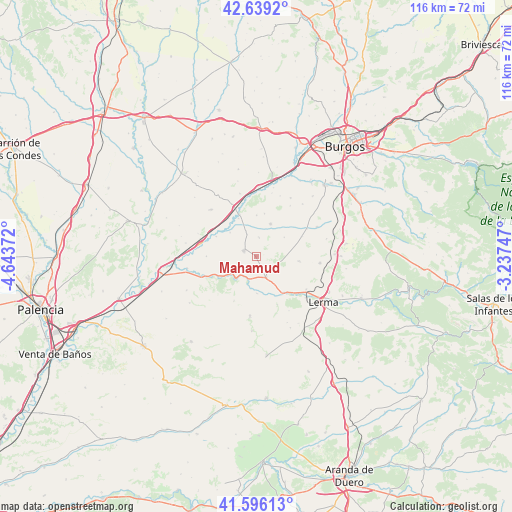
Mahamud GPS coordinates[2]
42° 7' 11.316" North, 3° 56' 26.16" West
| Map corner | latitude | longitude |
|---|---|---|
| Upper-left | 42.6392°, | -4.64372° |
| Center: | 42.11981°, | -3.9406° |
| Lower-right: | 41.59613°, | -3.23747° |
| Map W x H: | 116×116 km | = 72.1×72.1mi |
| max Lat: | 43.74134° ⇑22.9% North |
| Mahamud: | 42.11981° |
| min Lat: | ⇓77.1% South 27.64134° |
| min Long | Mahamud | max Long |
| -18.00367° | -3.9406° | 4.2899° |
| W 41.1%⇐ | ⇒58.9% E |
Elevation
Elevation of Mahamud is 830 m = 2723 ft, and this is 232 m = 761 ft above average elevation for this country.
| Max E: |
1682 m = 5518 ft | 27.5% |
| Mahamud | 830 m 2723 ft | |
| Avg. | 598 m = 1962 ft | |
Min E: |
0 m = 0 ft | 72.5% |
See also: Spain elevation on elevation.city.
Geographical zone
Mahamud is located in North temperate zone (between Tropic of Cancer and the Arctic Circle). Distance of this Northern Tropic circle is 2077.4 km =1290.8 mi to South.| Distance of | km | miles | from Mahamud |
|---|---|---|---|
| North Pole | 5323.8 | 3308.1 | to North |
| Arctic Circle | 2717.9 | 1688.8 | to North |
| Tropic Cancer | 2077.4 | 1290.8 | to South |
| Equator | 4683.3 | 2910.1 | to South |


Nearby cities:
15 places around Mahamud: (largest is in red/bold)
• Barrio de Muñó
8.3 km =5.2 mi,  318°
318°
• Belbimbre
8.1 km =5 mi,  312°
312°
• Ciadoncha
4.3 km =2.7 mi,  9°
9°
• Mazuela
9.9 km =6.2 mi, 10°
• Olmillos de Muñó
9.3 km =5.8 mi,  0°
0°
• Palazuelos de Muñó
9.5 km =5.9 mi,  334°
334°
• Pampliega
10.3 km =6.4 mi,  338°
338°
• Presencio
8.1 km =5 mi,  23°
23°
• Santa María del Campo
3 km =1.9 mi,  298°
298°
• Tordómar
10.3 km =6.4 mi,  142°
142°
• Valles de Palenzuela
11.3 km =7 mi,  270°
270°
• Villahoz
5.4 km =3.4 mi,  154°
154°
• Villaverde-Mogina
10.1 km =6.3 mi, 296°
• Villazopeque
10.8 km =6.7 mi, 324°
• Zael
9.6 km =6 mi,  99°
99°
Sources, notices
• [Note1] Compared only with cities in Spain existing in our database
• [Src1] Map data: © OpenStreetMap contributors (CC-BY-SA)
• [Src2] Other city data from geonames.org with taken over terms of usage.
• [Src3] Geographical zone / Annual Mean Temperature by Robert A. Rohde @ Wikipedia
