Lekeitio geodata
Lekeitio (Basque Country) is a seat of a third-order administrative division; located in Spain in Europe/Madrid (GMT+2) time zone. With population of 7,254 people, there are 1008 cities with bigger population in this country. Compared to other cities in Spain, 98.5% of cities are located further ↓South; 60.9% of cities are located further ←West and 95.4% of cities have higher elevation than Lekeitio. Note1


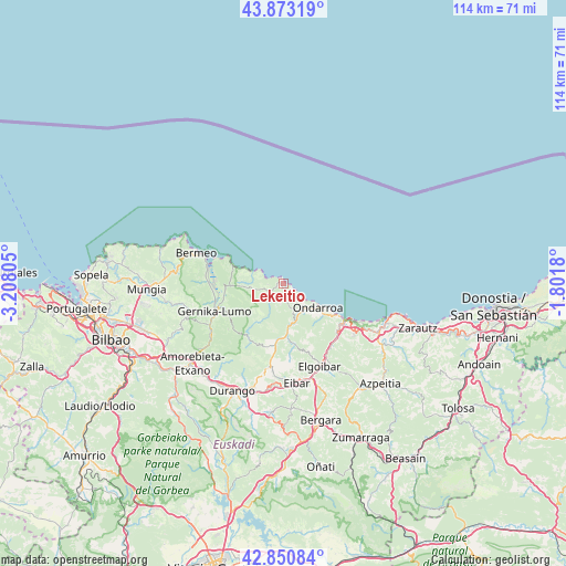
Lekeitio GPS coordinates[2]
43° 21' 51.012" North, 2° 30' 17.712" West
| Map corner | latitude | longitude |
|---|---|---|
| Upper-left | 43.87319°, | -3.20805° |
| Center: | 43.36417°, | -2.50492° |
| Lower-right: | 42.85084°, | -1.8018° |
| Map W x H: | 113.7×113.7 km | = 70.6×70.6mi |
| max Lat: | 43.74134° ⇑1.5% North |
| Lekeitio: | 43.36417° |
| min Lat: | ⇓98.5% South 27.64134° |
| min Long | Lekeitio | max Long |
| -18.00367° | -2.50492° | 4.2899° |
| W 60.9%⇐ | ⇒39.1% E |
Elevation
Elevation of Lekeitio is 23 m = 75 ft, and this is 575 m = 1886 ft below average elevation for this country.
| Max E: |
1682 m = 5518 ft | 95.4% |
| Avg. | 598 m = 1962 ft | |
| Lekeitio | 23 m = 75 ft | |
Min E: |
0 m = 0 ft | 4.6% |
See also: Spain elevation on elevation.city.
Geographical zone
Lekeitio is located in North temperate zone (between Tropic of Cancer and the Arctic Circle). Distance of this Northern Tropic circle is 2215.7 km =1376.8 mi to South.| Distance of | km | miles | from Lekeitio |
|---|---|---|---|
| North Pole | 5185.4 | 3222.1 | to North |
| Arctic Circle | 2579.5 | 1602.8 | to North |
| Tropic Cancer | 2215.7 | 1376.8 | to South |
| Equator | 4821.6 | 2996 | to South |


Nearby cities:
15 places around Lekeitio: (largest is in red/bold)
• Amoroto
4.3 km =2.7 mi,  189°
189°
• Aulesti
8.7 km =5.4 mi,  214°
214°
• Berriatua
6.1 km =3.8 mi,  149°
149°
• Deba
14.5 km =9 mi,  121°
121°
• Ea
6.7 km =4.2 mi,  284°
284°
• Elantxobe
11.6 km =7.2 mi,  291°
291°
• Etxebarria
12.4 km =7.7 mi,  169°
169°
• Forua
14.2 km =8.8 mi,  256°
256°
• Ibarrangelu
10.8 km =6.7 mi, 285°
• Ispaster
2.3 km =1.4 mi, 276°
• Kortezubi
12.2 km =7.6 mi,  253°
253°
• Markina-Xemein
10.8 km =6.7 mi,  177°
177°
• Mendexa
2.6 km =1.6 mi,  140°
140°
• Mutriku
11.6 km =7.2 mi, 123°
• Ondarroa
8.9 km =5.5 mi,  126°
126°
Sources, notices
• [Note1] Compared only with cities in Spain existing in our database
• [Src1] Map data: © OpenStreetMap contributors (CC-BY-SA)
• [Src2] Other city data from geonames.org with taken over terms of usage.
• [Src3] Geographical zone / Annual Mean Temperature by Robert A. Rohde @ Wikipedia
