Ispaster geodata
Ispaster (Basque Country) is a populated place; located in Spain in Europe/Madrid (GMT+2) time zone. With population of 616 people, there are 3577 cities with bigger population in this country. Compared to other cities in Spain, 98.5% of cities are located further ↓South; 60.5% of cities are located further ←West and 75.9% of cities have higher elevation than Ispaster. Note1


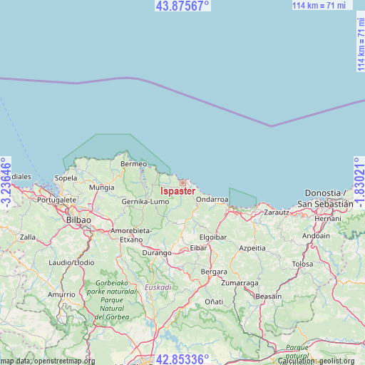
Ispaster GPS coordinates[2]
43° 22' 0.012" North, 2° 31' 59.988" West
| Map corner | latitude | longitude |
|---|---|---|
| Upper-left | 43.87567°, | -3.23646° |
| Center: | 43.36667°, | -2.53333° |
| Lower-right: | 42.85336°, | -1.83021° |
| Map W x H: | 113.7×113.7 km | = 70.6×70.6mi |
| max Lat: | 43.74134° ⇑1.5% North |
| Ispaster: | 43.36667° |
| min Lat: | ⇓98.5% South 27.64134° |
| min Long | Ispaster | max Long |
| -18.00367° | -2.53333° | 4.2899° |
| W 60.5%⇐ | ⇒39.5% E |
Elevation
Elevation of Ispaster is 286 m = 938 ft, and this is 312 m = 1024 ft below average elevation for this country.
| Max E: |
1682 m = 5518 ft | 75.9% |
| Avg. | 598 m = 1962 ft | |
| Ispaster | 286 m = 938 ft | |
Min E: |
0 m = 0 ft | 24.1% |
See also: Spain elevation on elevation.city.
Geographical zone
Ispaster is located in North temperate zone (between Tropic of Cancer and the Arctic Circle). Distance of this Northern Tropic circle is 2216 km =1377 mi to South.| Distance of | km | miles | from Ispaster |
|---|---|---|---|
| North Pole | 5185.1 | 3221.9 | to North |
| Arctic Circle | 2579.3 | 1602.7 | to North |
| Tropic Cancer | 2216 | 1377 | to South |
| Equator | 4821.9 | 2996.2 | to South |


Nearby cities:
15 places around Ispaster: (largest is in red/bold)
• Amoroto
4.8 km =3 mi,  160°
160°
• Aulesti
7.9 km =4.9 mi,  199°
199°
• Axpe de Busturia
13.4 km =8.3 mi,  278°
278°
• Berriatua
7.7 km =4.8 mi,  135°
135°
• Ea
4.5 km =2.8 mi,  289°
289°
• Elantxobe
9.4 km =5.8 mi, 294°
• Etxebarria
13.3 km =8.3 mi, 160°
• Forua
12 km =7.5 mi,  252°
252°
• Gernika-Lumo
13.3 km =8.3 mi, 245°
• Ibarrangelu
8.6 km =5.3 mi, 287°
• Kortezubi
10.1 km =6.3 mi, 248°
• Lekeitio
2.3 km =1.4 mi,  96°
96°
• Markina-Xemein
11.4 km =7.1 mi,  166°
166°
• Mendexa
4.6 km =2.9 mi,  120°
120°
• Ondarroa
11 km =6.8 mi, 120°
Sources, notices
• [Note1] Compared only with cities in Spain existing in our database
• [Src1] Map data: © OpenStreetMap contributors (CC-BY-SA)
• [Src2] Other city data from geonames.org with taken over terms of usage.
• [Src3] Geographical zone / Annual Mean Temperature by Robert A. Rohde @ Wikipedia
