Laspaúles geodata
Laspaúles (Aragon) is a seat of a third-order administrative division; located in Spain in Europe/Madrid (GMT+2) time zone. With population of 272 people, there are 4621 cities with bigger population in this country. Compared to other cities in Spain, 86.5% of cities are located further ↓South; 89.3% of cities are located further ←West and 99.7% of cities have lower elevation than Laspaúles. Note1


Laspaúles GPS coordinates[2]
42° 28' 16.896" North, 0° 35' 49.128" East
| Map corner | latitude | longitude |
|---|---|---|
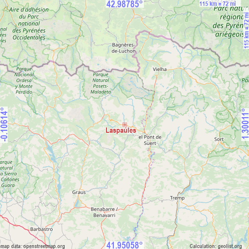
| Upper-left | 42.98785°, | -0.10614° |
| Center: | 42.47136°, | 0.59698° |
| Lower-right: | 41.95058°, | 1.30011° |
| Map W x H: | 115.3×115.3 km | = 71.6×71.6mi |
| max Lat: | 43.74134° ⇑13.5% North |
| Laspaúles: | 42.47136° |
| min Lat: | ⇓86.5% South 27.64134° |
| min Long | Laspaúles | max Long |
| -18.00367° | 0.59698° | 4.2899° |
| W 89.3%⇐ | ⇒10.7% E |
Elevation
Elevation of Laspaúles is 1457 m = 4780 ft, and this is 859 m = 2818 ft above average elevation for this country.
| Max E: |
1682 m = 5518 ft | 0.3% |
| Laspaúles | 1457 m 4780 ft | |
| Avg. | 598 m = 1962 ft | |
Min E: |
0 m = 0 ft | 99.7% |
See also: Spain elevation on elevation.city.
Geographical zone
Laspaúles is located in North temperate zone (between Tropic of Cancer and the Arctic Circle). Distance of this Northern Tropic circle is 2116.5 km =1315.1 mi to South.| Distance of | km | miles | from Laspaúles |
|---|---|---|---|
| North Pole | 5284.7 | 3283.8 | to North |
| Arctic Circle | 2678.8 | 1664.5 | to North |
| Tropic Cancer | 2116.5 | 1315.1 | to South |
| Equator | 4722.4 | 2934.4 | to South |


Nearby cities:
15 places around Laspaúles: (largest is in red/bold)
• Barruera
17.1 km =10.6 mi,  77°
77°
• Benasque
16.1 km =10 mi,  337°
337°
• Beranuy
11.7 km =7.3 mi,  181°
181°
• Bisaurri
7.9 km =4.9 mi,  290°
290°
• Bonansa
7.6 km =4.7 mi,  130°
130°
• Campo
17.9 km =11.1 mi,  247°
247°
• Castejón de Sos
9.7 km =6 mi,  297°
297°
• Chía
12.1 km =7.5 mi, 297°
• Plan
24.5 km =15.2 mi, 299°
• Sahún
15.9 km =9.9 mi,  317°
317°
• Seira
13.6 km =8.5 mi,  272°
272°
• Sesué
13.6 km =8.5 mi,  310°
310°
• Sopeira
21.2 km =13.2 mi,  144°
144°
• Vilaller
9.8 km =6.1 mi,  86°
86°
• Villanova
13.9 km =8.6 mi, 307°
Sources, notices
• [Note1] Compared only with cities in Spain existing in our database
• [Src1] Map data: © OpenStreetMap contributors (CC-BY-SA)
• [Src2] Other city data from geonames.org with taken over terms of usage.
• [Src3] Geographical zone / Annual Mean Temperature by Robert A. Rohde @ Wikipedia
