Bonansa geodata
Bonansa (Aragon) is a seat of a third-order administrative division; located in Spain in Europe/Madrid (GMT+2) time zone. With population of 106 people, there are 5853 cities with bigger population in this country. Compared to other cities in Spain, 85.6% of cities are located further ↓South; 89.6% of cities are located further ←West and 97.8% of cities have lower elevation than Bonansa. Note1


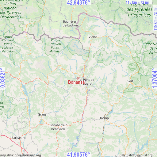
Bonansa GPS coordinates[2]
42° 25' 36.876" North, 0° 40' 0.912" East
| Map corner | latitude | longitude |
|---|---|---|
| Upper-left | 42.94376°, | -0.03621° |
| Center: | 42.42691°, | 0.66692° |
| Lower-right: | 41.90576°, | 1.37004° |
| Map W x H: | 115.4×115.4 km | = 71.7×71.7mi |
| max Lat: | 43.74134° ⇑14.4% North |
| Bonansa: | 42.42691° |
| min Lat: | ⇓85.6% South 27.64134° |
| min Long | Bonansa | max Long |
| -18.00367° | 0.66692° | 4.2899° |
| W 89.6%⇐ | ⇒10.4% E |
Elevation
Elevation of Bonansa is 1244 m = 4081 ft, and this is 646 m = 2119 ft above average elevation for this country.
| Max E: |
1682 m = 5518 ft | 2.2% |
| Bonansa | 1244 m 4081 ft | |
| Avg. | 598 m = 1962 ft | |
Min E: |
0 m = 0 ft | 97.8% |
See also: Spain elevation on elevation.city.
Geographical zone
Bonansa is located in North temperate zone (between Tropic of Cancer and the Arctic Circle). Distance of this Northern Tropic circle is 2111.5 km =1312 mi to South.| Distance of | km | miles | from Bonansa |
|---|---|---|---|
| North Pole | 5289.6 | 3286.8 | to North |
| Arctic Circle | 2683.7 | 1667.6 | to North |
| Tropic Cancer | 2111.5 | 1312 | to South |
| Equator | 4717.4 | 2931.3 | to South |


Nearby cities:
15 places around Bonansa: (largest is in red/bold)
• Areny de Noguera / Arén
19.3 km =12 mi,  166°
166°
• Barruera
14 km =8.7 mi,  51°
51°
• Benasque
23.1 km =14.4 mi,  329°
329°
• Beranuy
9 km =5.6 mi,  221°
221°
• Bisaurri
15.3 km =9.5 mi,  300°
300°
• Campo
22.3 km =13.9 mi,  265°
265°
• Castejón de Sos
17.2 km =10.7 mi, 303°
• Chía
19.5 km =12.1 mi, 302°
• Laspaúles
7.6 km =4.7 mi,  310°
310°
• Sahún
23.4 km =14.5 mi,  315°
315°
• Seira
20.1 km =12.5 mi,  286°
286°
• Sesué
21.1 km =13.1 mi, 310°
• Sopeira
13.9 km =8.6 mi,  152°
152°
• Vilaller
6.8 km =4.2 mi,  36°
36°
• Villanova
21.5 km =13.4 mi, 308°
Sources, notices
• [Note1] Compared only with cities in Spain existing in our database
• [Src1] Map data: © OpenStreetMap contributors (CC-BY-SA)
• [Src2] Other city data from geonames.org with taken over terms of usage.
• [Src3] Geographical zone / Annual Mean Temperature by Robert A. Rohde @ Wikipedia
