Josa geodata
Josa (Aragon) is a seat of a third-order administrative division; located in Spain in Europe/Madrid (GMT+2) time zone. With population of 28 people, there are 6678 cities with bigger population in this country. Compared to other cities in Spain, 52.7% of cities are located further ↑North; 79.2% of cities are located further ←West and 64% of cities have lower elevation than Josa. Note1


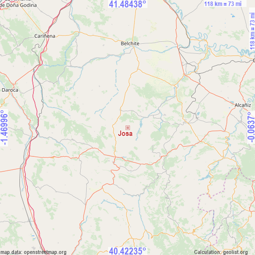
Josa GPS coordinates[2]
40° 57' 19.8" North, 0° 46' 0.588" West
| Map corner | latitude | longitude |
|---|---|---|
| Upper-left | 41.48438°, | -1.46996° |
| Center: | 40.9555°, | -0.76683° |
| Lower-right: | 40.42235°, | -0.0637° |
| Map W x H: | 118.1×118.1 km | = 73.4×73.4mi |
| max Lat: | 43.74134° ⇑52.7% North |
| Josa: | 40.9555° |
| min Lat: | ⇓47.3% South 27.64134° |
| min Long | Josa | max Long |
| -18.00367° | -0.76683° | 4.2899° |
| W 79.2%⇐ | ⇒20.8% E |
Elevation
Elevation of Josa is 771 m = 2530 ft, and this is 173 m = 568 ft above average elevation for this country.
| Max E: |
1682 m = 5518 ft | 36% |
| Josa | 771 m 2530 ft | |
| Avg. | 598 m = 1962 ft | |
Min E: |
0 m = 0 ft | 64% |
See also: Spain elevation on elevation.city.
Geographical zone
Josa is located in North temperate zone (between Tropic of Cancer and the Arctic Circle). Distance of this Northern Tropic circle is 1947.9 km =1210.4 mi to South.| Distance of | km | miles | from Josa |
|---|---|---|---|
| North Pole | 5453.2 | 3388.5 | to North |
| Arctic Circle | 2847.3 | 1769.2 | to North |
| Tropic Cancer | 1947.9 | 1210.4 | to South |
| Equator | 4553.8 | 2829.6 | to South |


Nearby cities:
15 places around Josa: (largest is in red/bold)
• Alacón
9.7 km =6 mi,  36°
36°
• Alcaine
5.1 km =3.2 mi,  92°
92°
• Blesa
14.6 km =9.1 mi,  317°
317°
• Cortes de Aragón
6.1 km =3.8 mi,  289°
289°
• Estercuel
15.9 km =9.9 mi,  134°
134°
• Huesa del Común
14.1 km =8.8 mi,  295°
295°
• Maicas
10.5 km =6.5 mi,  277°
277°
• Martín del Río
16.4 km =10.2 mi,  221°
221°
• Montalbán
14 km =8.7 mi,  192°
192°
• Muniesa
9.4 km =5.8 mi,  336°
336°
• Obón
6.8 km =4.2 mi,  147°
147°
• Oliete
9.1 km =5.7 mi,  58°
58°
• Plou
8.4 km =5.2 mi, 299°
• Segura de los Baños
15.6 km =9.7 mi,  264°
264°
• Torre de las Arcas
13.3 km =8.3 mi,  161°
161°
Sources, notices
• [Note1] Compared only with cities in Spain existing in our database
• [Src1] Map data: © OpenStreetMap contributors (CC-BY-SA)
• [Src2] Other city data from geonames.org with taken over terms of usage.
• [Src3] Geographical zone / Annual Mean Temperature by Robert A. Rohde @ Wikipedia
