Iruelos geodata
Iruelos (Castille and León) is a seat of a third-order administrative division; located in Spain in Europe/Madrid (GMT+2) time zone. With population of 54 people, there are 6416 cities with bigger population in this country. Compared to other cities in Spain, 51.9% of cities are located further ↓South; 89.6% of cities are located further →East and 66.1% of cities have lower elevation than Iruelos. Note1
Administrative division(s):
- Level 1: Castille and León
- Level 2: Provincia de Salamanca
- Level 3: Iruelos


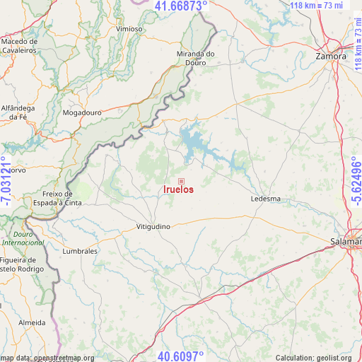
Iruelos GPS coordinates[2]
41° 8' 28.86" North, 6° 19' 41.088" West
| Map corner | latitude | longitude |
|---|---|---|
| Upper-left | 41.66873°, | -7.03121° |
| Center: | 41.14135°, | -6.32808° |
| Lower-right: | 40.6097°, | -5.62496° |
| Map W x H: | 117.8×117.8 km | = 73.2×73.2mi |
| max Lat: | 43.74134° ⇑48.1% North |
| Iruelos: | 41.14135° |
| min Lat: | ⇓51.9% South 27.64134° |
| min Long | Iruelos | max Long |
| -18.00367° | -6.32808° | 4.2899° |
| W 10.4%⇐ | ⇒89.6% E |
Elevation
Elevation of Iruelos is 785 m = 2575 ft, and this is 187 m = 614 ft above average elevation for this country.
| Max E: |
1682 m = 5518 ft | 33.9% |
| Iruelos | 785 m 2575 ft | |
| Avg. | 598 m = 1962 ft | |
Min E: |
0 m = 0 ft | 66.1% |
See also: Spain elevation on elevation.city.
Geographical zone
Iruelos is located in North temperate zone (between Tropic of Cancer and the Arctic Circle). Distance of this Northern Tropic circle is 1968.6 km =1223.2 mi to South.| Distance of | km | miles | from Iruelos |
|---|---|---|---|
| North Pole | 5432.6 | 3375.7 | to North |
| Arctic Circle | 2826.7 | 1756.4 | to North |
| Tropic Cancer | 1968.6 | 1223.2 | to South |
| Equator | 4574.5 | 2842.5 | to South |


Nearby cities:
15 places around Iruelos: (largest is in red/bold)
• Ahigal de Villarino
4.8 km =3 mi,  293°
293°
• Almendra
9.8 km =6.1 mi,  353°
353°
• Barceo
13.7 km =8.5 mi,  229°
229°
• Brincones
3.6 km =2.2 mi,  208°
208°
• Espadaña
9.7 km =6 mi,  157°
157°
• Monleras
9.9 km =6.2 mi,  59°
59°
• Puertas
6 km =3.7 mi,  145°
145°
• Sanchón de la Ribera
9.2 km =5.7 mi, 230°
• Sardón de los Frailes
9.4 km =5.8 mi,  30°
30°
• Trabanca
11.2 km =7 mi,  334°
334°
• Tremedal de Tormes
14.4 km =8.9 mi,  121°
121°
• Villar de Peralonso
15 km =9.3 mi,  143°
143°
• Villar de Samaniego
9.2 km =5.7 mi,  252°
252°
• Villarmuerto
9.9 km =6.2 mi,  197°
197°
• Villaseco de los Reyes
12.3 km =7.6 mi,  78°
78°
Sources, notices
• [Note1] Compared only with cities in Spain existing in our database
• [Src1] Map data: © OpenStreetMap contributors (CC-BY-SA)
• [Src2] Other city data from geonames.org with taken over terms of usage.
• [Src3] Geographical zone / Annual Mean Temperature by Robert A. Rohde @ Wikipedia
