Husillos geodata
Husillos (Castille and León) is a seat of a third-order administrative division; located in Spain in Europe/Madrid (GMT+2) time zone. With population of 200 people, there are 5036 cities with bigger population in this country. Compared to other cities in Spain, 76.3% of cities are located further ↓South; 66.6% of cities are located further →East and 59.9% of cities have lower elevation than Husillos. Note1
Administrative division(s):
- Level 1: Castille and León
- Level 2: Provincia de Palencia
- Level 3: Husillos


Husillos GPS coordinates[2]
42° 5' 25.944" North, 4° 31' 37.524" West
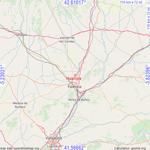
| Map corner | latitude | longitude |
|---|---|---|
| Upper-left | 42.61017°, | -5.23021° |
| Center: | 42.09054°, | -4.52709° |
| Lower-right: | 41.56662°, | -3.82396° |
| Map W x H: | 116×116 km | = 72.1×72.1mi |
| max Lat: | 43.74134° ⇑23.7% North |
| Husillos: | 42.09054° |
| min Lat: | ⇓76.3% South 27.64134° |
| min Long | Husillos | max Long |
| -18.00367° | -4.52709° | 4.2899° |
| W 33.4%⇐ | ⇒66.6% E |
Elevation
Elevation of Husillos is 744 m = 2441 ft, and this is 146 m = 479 ft above average elevation for this country.
| Max E: |
1682 m = 5518 ft | 40.1% |
| Husillos | 744 m 2441 ft | |
| Avg. | 598 m = 1962 ft | |
Min E: |
0 m = 0 ft | 59.9% |
See also: Spain elevation on elevation.city.
Geographical zone
Husillos is located in North temperate zone (between Tropic of Cancer and the Arctic Circle). Distance of this Northern Tropic circle is 2074.1 km =1288.8 mi to South.| Distance of | km | miles | from Husillos |
|---|---|---|---|
| North Pole | 5327 | 3310 | to North |
| Arctic Circle | 2721.1 | 1690.8 | to North |
| Tropic Cancer | 2074.1 | 1288.8 | to South |
| Equator | 4680 | 2908 | to South |


Nearby cities:
15 places around Husillos: (largest is in red/bold)
• Amayuelas de Arriba
13.8 km =8.6 mi,  13°
13°
• Amusco
10.3 km =6.4 mi,  27°
27°
• Becerril de Campos
9.6 km =6 mi,  281°
281°
• Fuentes de Valdepero
2.8 km =1.7 mi,  127°
127°
• Grijota
6.2 km =3.9 mi,  227°
227°
• Manquillos
13.2 km =8.2 mi,  345°
345°
• Monzón de Campos
4 km =2.5 mi,  44°
44°
• Palencia
9 km =5.6 mi,  178°
178°
• Perales
12.3 km =7.6 mi,  338°
338°
• Ribas de Campos
6.9 km =4.3 mi, 7°
• San Cebrián de Campos
12.2 km =7.6 mi,  358°
358°
• Valdeolmillos
11.8 km =7.3 mi,  117°
117°
• Villalobón
7 km =4.3 mi,  163°
163°
• Villamartín de Campos
14 km =8.7 mi, 233°
• Villaumbrales
7.2 km =4.5 mi,  268°
268°
Sources, notices
• [Note1] Compared only with cities in Spain existing in our database
• [Src1] Map data: © OpenStreetMap contributors (CC-BY-SA)
• [Src2] Other city data from geonames.org with taken over terms of usage.
• [Src3] Geographical zone / Annual Mean Temperature by Robert A. Rohde @ Wikipedia
