Gajates geodata
Gajates (Castille and León) is a seat of a third-order administrative division; located in Spain in Europe/Madrid (GMT+2) time zone. With population of 187 people, there are 5129 cities with bigger population in this country. Compared to other cities in Spain, 56.6% of cities are located further ↑North; 77% of cities are located further →East and 75.5% of cities have lower elevation than Gajates. Note1
Administrative division(s):
- Level 1: Castille and León
- Level 2: Provincia de Salamanca
- Level 3: Gajates


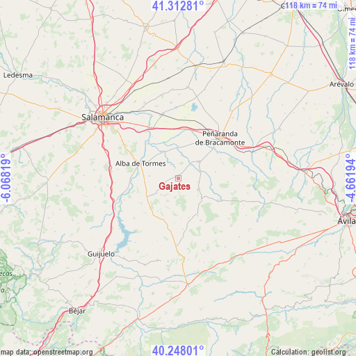
Gajates GPS coordinates[2]
40° 46' 57.144" North, 5° 21' 54.216" West
| Map corner | latitude | longitude |
|---|---|---|
| Upper-left | 41.31281°, | -6.06819° |
| Center: | 40.78254°, | -5.36506° |
| Lower-right: | 40.24801°, | -4.66194° |
| Map W x H: | 118.4×118.4 km | = 73.6×73.6mi |
| max Lat: | 43.74134° ⇑56.6% North |
| Gajates: | 40.78254° |
| min Lat: | ⇓43.4% South 27.64134° |
| min Long | Gajates | max Long |
| -18.00367° | -5.36506° | 4.2899° |
| W 23%⇐ | ⇒77% E |
Elevation
Elevation of Gajates is 856 m = 2808 ft, and this is 258 m = 846 ft above average elevation for this country.
| Max E: |
1682 m = 5518 ft | 24.5% |
| Gajates | 856 m 2808 ft | |
| Avg. | 598 m = 1962 ft | |
Min E: |
0 m = 0 ft | 75.5% |
See also: Spain elevation on elevation.city.
Geographical zone
Gajates is located in North temperate zone (between Tropic of Cancer and the Arctic Circle). Distance of this Northern Tropic circle is 1928.7 km =1198.4 mi to South.| Distance of | km | miles | from Gajates |
|---|---|---|---|
| North Pole | 5472.5 | 3400.5 | to North |
| Arctic Circle | 2866.6 | 1781.2 | to North |
| Tropic Cancer | 1928.7 | 1198.4 | to South |
| Equator | 4534.6 | 2817.7 | to South |


Nearby cities:
15 places around Gajates: (largest is in red/bold)
• Alaraz
7.5 km =4.7 mi,  119°
119°
• Aldeaseca de Alba
8 km =5 mi,  300°
300°
• Anaya de Alba
12.3 km =7.6 mi,  240°
240°
• Coca de Alba
10.7 km =6.6 mi,  359°
359°
• Garcihernández
10.6 km =6.6 mi,  325°
325°
• Larrodrigo
8.7 km =5.4 mi,  234°
234°
• Macotera
8.6 km =5.3 mi,  51°
51°
• Malpartida
11.5 km =7.1 mi,  101°
101°
• Navales
9.6 km =6 mi,  274°
274°
• Pedraza de Alba
3.2 km =2 mi,  195°
195°
• Pedrosillo de Alba
5.1 km =3.2 mi, 330°
• Peñarandilla
11.5 km =7.1 mi,  347°
347°
• Santiago de la Puebla
7.4 km =4.6 mi,  73°
73°
• Tordillos
7.9 km =4.9 mi,  7°
7°
• Valdecarros
5 km =3.1 mi,  253°
253°
Sources, notices
• [Note1] Compared only with cities in Spain existing in our database
• [Src1] Map data: © OpenStreetMap contributors (CC-BY-SA)
• [Src2] Other city data from geonames.org with taken over terms of usage.
• [Src3] Geographical zone / Annual Mean Temperature by Robert A. Rohde @ Wikipedia
