Pozo de Urama geodata
Pozo de Urama (Castille and León) is a seat of a third-order administrative division; located in Spain in Europe/Madrid (GMT+2) time zone. With population of 45 people, there are 6517 cities with bigger population in this country. Compared to other cities in Spain, 80.7% of cities are located further ↓South; 71% of cities are located further →East and 71.3% of cities have lower elevation than Pozo de Urama. Note1
Administrative division(s):
- Level 1: Castille and León
- Level 2: Provincia de Palencia
- Level 3: Pozo de Urama


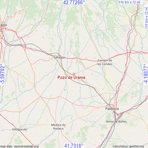
Pozo de Urama GPS coordinates[2]
42° 15' 15.768" North, 4° 53' 38.004" West
| Map corner | latitude | longitude |
|---|---|---|
| Upper-left | 42.77266°, | -5.59702° |
| Center: | 42.25438°, | -4.89389° |
| Lower-right: | 41.7318°, | -4.19077° |
| Map W x H: | 115.7×115.7 km | = 71.9×71.9mi |
| max Lat: | 43.74134° ⇑19.3% North |
| Pozo de Urama: | 42.25438° |
| min Lat: | ⇓80.7% South 27.64134° |
| min Long | Pozo de Urama | max Long |
| -18.00367° | -4.89389° | 4.2899° |
| W 29%⇐ | ⇒71% E |
Elevation
Elevation of Pozo de Urama is 823 m = 2700 ft, and this is 225 m = 738 ft above average elevation for this country.
| Max E: |
1682 m = 5518 ft | 28.7% |
| Pozo de Urama | 823 m 2700 ft | |
| Avg. | 598 m = 1962 ft | |
Min E: |
0 m = 0 ft | 71.3% |
See also: Spain elevation on elevation.city.
Geographical zone
Pozo de Urama is located in North temperate zone (between Tropic of Cancer and the Arctic Circle). Distance of this Northern Tropic circle is 2092.3 km =1300.1 mi to South.| Distance of | km | miles | from Pozo de Urama |
|---|---|---|---|
| North Pole | 5308.8 | 3298.7 | to North |
| Arctic Circle | 2702.9 | 1679.5 | to North |
| Tropic Cancer | 2092.3 | 1300.1 | to South |
| Equator | 4698.2 | 2919.3 | to South |


Nearby cities:
15 places around Pozo de Urama: (largest is in red/bold)
• Cervatos de la Cueza
11 km =6.8 mi,  68°
68°
• Cisneros
4.8 km =3 mi,  141°
141°
• Escobar de Campos
8.8 km =5.5 mi,  317°
317°
• Frechilla
13.7 km =8.5 mi,  161°
161°
• Grajal de Campos
12.7 km =7.9 mi,  305°
305°
• Guaza de Campos
13.5 km =8.4 mi,  185°
185°
• Ledigos
11.4 km =7.1 mi,  12°
12°
• Mazuecos de Valdeginate
10.5 km =6.5 mi, 155°
• Moratinos
12.3 km =7.6 mi,  346°
346°
• Población de Arroyo
9.3 km =5.8 mi, 10°
• San Román de la Cuba
3.2 km =2 mi, 73°
• Villacidaler
7.7 km =4.8 mi,  241°
241°
• Villada
6 km =3.7 mi,  266°
266°
• Villalcón
5.3 km =3.3 mi,  36°
36°
• Villanueva del Rebollar
12.5 km =7.8 mi,  96°
96°
Sources, notices
• [Note1] Compared only with cities in Spain existing in our database
• [Src1] Map data: © OpenStreetMap contributors (CC-BY-SA)
• [Src2] Other city data from geonames.org with taken over terms of usage.
• [Src3] Geographical zone / Annual Mean Temperature by Robert A. Rohde @ Wikipedia
