Farrera geodata
Farrera (Catalonia) is a seat of a third-order administrative division; located in Spain in Europe/Madrid (GMT+2) time zone. With population of 105 people, there are 5867 cities with bigger population in this country. Compared to other cities in Spain, 87.1% of cities are located further ↓South; 91.2% of cities are located further ←West and 99.1% of cities have lower elevation than Farrera. Note1


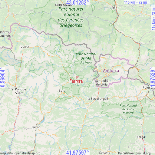
Farrera GPS coordinates[2]
42° 29' 47.544" North, 1° 16' 19.776" East
| Map corner | latitude | longitude |
|---|---|---|
| Upper-left | 43.01282°, | 0.56904° |
| Center: | 42.49654°, | 1.27216° |
| Lower-right: | 41.97597°, | 1.97529° |
| Map W x H: | 115.3×115.3 km | = 71.6×71.6mi |
| max Lat: | 43.74134° ⇑12.9% North |
| Farrera: | 42.49654° |
| min Lat: | ⇓87.1% South 27.64134° |
| min Long | Farrera | max Long |
| -18.00367° | 1.27216° | 4.2899° |
| W 91.2%⇐ | ⇒8.8% E |
Elevation
Elevation of Farrera is 1355 m = 4446 ft, and this is 757 m = 2484 ft above average elevation for this country.
| Max E: |
1682 m = 5518 ft | 0.90000000000001% |
| Farrera | 1355 m 4446 ft | |
| Avg. | 598 m = 1962 ft | |
Min E: |
0 m = 0 ft | 99.1% |
See also: Spain elevation on elevation.city.
Geographical zone
Farrera is located in North temperate zone (between Tropic of Cancer and the Arctic Circle). Distance of this Northern Tropic circle is 2119.3 km =1316.9 mi to South.| Distance of | km | miles | from Farrera |
|---|---|---|---|
| North Pole | 5281.9 | 3282 | to North |
| Arctic Circle | 2676 | 1662.8 | to North |
| Tropic Cancer | 2119.3 | 1316.9 | to South |
| Equator | 4725.2 | 2936.1 | to South |


Nearby cities:
15 places around Farrera: (largest is in red/bold)
• Alàs i Cerc
25.9 km =16.1 mi,  129°
129°
• Barruera
38.7 km =24 mi,  271°
271°
• Bellver de Cerdanya
44.4 km =27.6 mi,  108°
108°
• Coll de Nargó
36 km =22.4 mi,  174°
174°
• Espot
17.7 km =11 mi,  300°
300°
• Gósol
43 km =26.7 mi, 132°
• La Seu d'Urgell
21.8 km =13.5 mi, 134°
• Lles de Cerdanya
36 km =22.4 mi, 109°
• Meranges
42.7 km =26.5 mi,  97°
97°
• Senterada
33.5 km =20.8 mi,  235°
235°
• Sort
14.9 km =9.3 mi,  231°
231°
• Toloriu
32.8 km =20.4 mi,  117°
117°
• Vielha
45.2 km =28.1 mi, 300°
• el Pont de Bar
30.7 km =19.1 mi, 117°
• Éller
43.6 km =27.1 mi, 101°
Sources, notices
• [Note1] Compared only with cities in Spain existing in our database
• [Src1] Map data: © OpenStreetMap contributors (CC-BY-SA)
• [Src2] Other city data from geonames.org with taken over terms of usage.
• [Src3] Geographical zone / Annual Mean Temperature by Robert A. Rohde @ Wikipedia
