Codorniz geodata
Codorniz (Castille and León) is a seat of a third-order administrative division; located in Spain in Europe/Madrid (GMT+2) time zone. With population of 456 people, there are 3995 cities with bigger population in this country. Compared to other cities in Spain, 50.2% of cities are located further ↓South; 67.3% of cities are located further →East and 79.2% of cities have lower elevation than Codorniz. Note1
Administrative division(s):
- Level 1: Castille and León
- Level 2: Provincia de Segovia
- Level 3: Codorniz


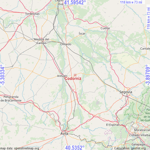
Codorniz GPS coordinates[2]
41° 4' 2.82" North, 4° 36' 0.756" West
| Map corner | latitude | longitude |
|---|---|---|
| Upper-left | 41.59542°, | -5.30334° |
| Center: | 41.06745°, | -4.60021° |
| Lower-right: | 40.5352°, | -3.89709° |
| Map W x H: | 117.9×117.9 km | = 73.3×73.3mi |
| max Lat: | 43.74134° ⇑49.8% North |
| Codorniz: | 41.06745° |
| min Lat: | ⇓50.2% South 27.64134° |
| min Long | Codorniz | max Long |
| -18.00367° | -4.60021° | 4.2899° |
| W 32.7%⇐ | ⇒67.3% E |
Elevation
Elevation of Codorniz is 890 m = 2920 ft, and this is 292 m = 958 ft above average elevation for this country.
| Max E: |
1682 m = 5518 ft | 20.8% |
| Codorniz | 890 m 2920 ft | |
| Avg. | 598 m = 1962 ft | |
Min E: |
0 m = 0 ft | 79.2% |
See also: Spain elevation on elevation.city.
Geographical zone
Codorniz is located in North temperate zone (between Tropic of Cancer and the Arctic Circle). Distance of this Northern Tropic circle is 1960.4 km =1218.1 mi to South.| Distance of | km | miles | from Codorniz |
|---|---|---|---|
| North Pole | 5440.8 | 3380.8 | to North |
| Arctic Circle | 2834.9 | 1761.5 | to North |
| Tropic Cancer | 1960.4 | 1218.1 | to South |
| Equator | 4566.3 | 2837.4 | to South |


Nearby cities:
15 places around Codorniz: (largest is in red/bold)
• Aldeanueva del Codonal
5 km =3.1 mi,  70°
70°
• Aldehuela del Codonal
5.3 km =3.3 mi,  104°
104°
• Arévalo
10.1 km =6.3 mi,  266°
266°
• Donhierro
9.7 km =6 mi,  303°
303°
• Gutierre-Muñoz
9.9 km =6.2 mi,  198°
198°
• Juarros de Voltoya
7.9 km =4.9 mi,  120°
120°
• Martín Muñoz de la Dehesa
7.3 km =4.5 mi, 269°
• Martín Muñoz de las Posadas
8 km =5 mi,  177°
177°
• Melque de Cercos
11.1 km =6.9 mi, 99°
• Montejo de Arévalo
9.7 km =6 mi,  326°
326°
• Orbita
8.7 km =5.4 mi,  207°
207°
• Rapariegos
5.4 km =3.4 mi, 304°
• San Cristóbal de la Vega
6.2 km =3.9 mi,  323°
323°
• Santiuste de San Juan Bautista
10.1 km =6.3 mi,  13°
13°
• Tolocirio
8.6 km =5.3 mi, 330°
Sources, notices
• [Note1] Compared only with cities in Spain existing in our database
• [Src1] Map data: © OpenStreetMap contributors (CC-BY-SA)
• [Src2] Other city data from geonames.org with taken over terms of usage.
• [Src3] Geographical zone / Annual Mean Temperature by Robert A. Rohde @ Wikipedia
