San Cristóbal de la Vega geodata
San Cristóbal de la Vega (Castille and León) is a seat of a third-order administrative division; located in Spain in Europe/Madrid (GMT+2) time zone. With population of 139 people, there are 5510 cities with bigger population in this country. Compared to other cities in Spain, 51.2% of cities are located further ↓South; 67.9% of cities are located further →East and 75.8% of cities have lower elevation than San Cristóbal de la Vega. Note1
Administrative division(s):
- Level 1: Castille and León
- Level 2: Provincia de Segovia
- Level 3: San Cristóbal de la Vega
Current local time in San Cristóbal de la Vega:
10:44 PM, ThursdayDifference from your time zone: hours


San Cristóbal de la Vega GPS coordinates[2]
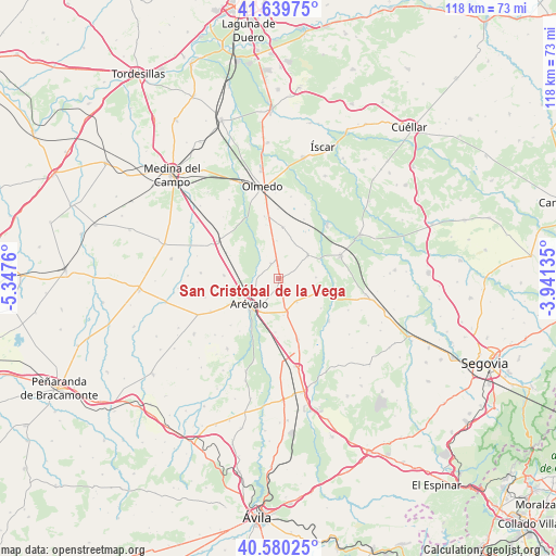
41° 6' 43.704" North, 4° 38' 40.128" West
| Map corner | latitude | longitude |
|---|---|---|
| Upper-left | 41.63975°, | -5.3476° |
| Center: | 41.11214°, | -4.64448° |
| Lower-right: | 40.58025°, | -3.94135° |
| Map W x H: | 117.8×117.8 km | = 73.2×73.2mi |
| max Lat: | 43.74134° ⇑48.8% North |
| San Cristóbal de la Vega: | 41.11214° |
| min Lat: | ⇓51.2% South 27.64134° |
| min Long | San Cristóbal | max Long |
| -18.00367° | -4.64448° | 4.2899° |
| W 32.1%⇐ | ⇒67.9% E |
Elevation
Elevation of San Cristóbal de la Vega is 859 m = 2818 ft, and this is 261 m = 856 ft above average elevation for this country.
| Max E: |
1682 m = 5518 ft | 24.2% |
| San Cristóbal de la Vega | 859 m 2818 ft | |
| Avg. | 598 m = 1962 ft | |
Min E: |
0 m = 0 ft | 75.8% |
See also: Spain elevation on elevation.city.
Geographical zone
San Cristóbal de la Vega is located in North temperate zone (between Tropic of Cancer and the Arctic Circle). Distance of this Northern Tropic circle is 1965.3 km =1221.2 mi to South.| Distance of | km | miles | from San Cristóbal de la Vega |
|---|---|---|---|
| North Pole | 5435.8 | 3377.6 | to North |
| Arctic Circle | 2829.9 | 1758.4 | to North |
| Tropic Cancer | 1965.3 | 1221.2 | to South |
| Equator | 4571.2 | 2840.4 | to South |


Nearby cities:
15 places around San Cristóbal de la Vega: (largest is in red/bold)
• Aldeanueva del Codonal
9.1 km =5.7 mi,  111°
111°
• Aldehuela del Codonal
10.9 km =6.8 mi,  125°
125°
• Almenara de Adaja
11.7 km =7.3 mi,  345°
345°
• Arévalo
8.4 km =5.2 mi,  229°
229°
• Codorniz
6.2 km =3.9 mi,  143°
143°
• Donhierro
4.4 km =2.7 mi,  276°
276°
• Fuente de Santa Cruz
10.9 km =6.8 mi,  4°
4°
• Martín Muñoz de la Dehesa
6.2 km =3.9 mi,  214°
214°
• Montejo de Arévalo
3.5 km =2.2 mi,  332°
332°
• Palacios de Goda
11.8 km =7.3 mi,  273°
273°
• Puras
7.9 km =4.9 mi,  356°
356°
• Rapariegos
2 km =1.2 mi,  199°
199°
• San Pablo de la Moraleja
12.4 km =7.7 mi,  295°
295°
• Santiuste de San Juan Bautista
7.8 km =4.8 mi,  51°
51°
• Tolocirio
2.5 km =1.6 mi, 347°
Sources, notices
• [Note1] Compared only with cities in Spain existing in our database
• [Src1] Map data: © OpenStreetMap contributors (CC-BY-SA)
• [Src2] Other city data from geonames.org with taken over terms of usage.
• [Src3] Geographical zone / Annual Mean Temperature by Robert A. Rohde @ Wikipedia
