Cincovillas geodata
Cincovillas (Castille-La Mancha) is a seat of a third-order administrative division; located in Spain in Europe/Madrid (GMT+2) time zone. With population of 39 people, there are 6576 cities with bigger population in this country. Compared to other cities in Spain, 53.2% of cities are located further ↓South; 57.2% of cities are located further ←West and 89.3% of cities have lower elevation than Cincovillas. Note1
Administrative division(s):
- Level 1: Castille-La Mancha
- Level 2: Provincia de Guadalajara
- Level 3: Cincovillas


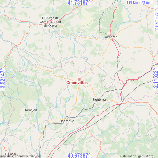
Cincovillas GPS coordinates[2]
41° 12' 18.036" North, 2° 49' 6.024" West
| Map corner | latitude | longitude |
|---|---|---|
| Upper-left | 41.73187°, | -3.52147° |
| Center: | 41.20501°, | -2.81834° |
| Lower-right: | 40.67387°, | -2.11522° |
| Map W x H: | 117.6×117.6 km | = 73.1×73.1mi |
| max Lat: | 43.74134° ⇑46.8% North |
| Cincovillas: | 41.20501° |
| min Lat: | ⇓53.2% South 27.64134° |
| min Long | Cincovillas | max Long |
| -18.00367° | -2.81834° | 4.2899° |
| W 57.2%⇐ | ⇒42.8% E |
Elevation
Elevation of Cincovillas is 1020 m = 3346 ft, and this is 422 m = 1385 ft above average elevation for this country.
| Max E: |
1682 m = 5518 ft | 10.7% |
| Cincovillas | 1020 m 3346 ft | |
| Avg. | 598 m = 1962 ft | |
Min E: |
0 m = 0 ft | 89.3% |
See also: Spain elevation on elevation.city.
Geographical zone
Cincovillas is located in North temperate zone (between Tropic of Cancer and the Arctic Circle). Distance of this Northern Tropic circle is 1975.6 km =1227.6 mi to South.| Distance of | km | miles | from Cincovillas |
|---|---|---|---|
| North Pole | 5425.5 | 3371.2 | to North |
| Arctic Circle | 2819.6 | 1752 | to North |
| Tropic Cancer | 1975.6 | 1227.6 | to South |
| Equator | 4581.6 | 2846.9 | to South |


Nearby cities:
15 places around Cincovillas: (largest is in red/bold)
• Alcolea de las Peñas
2.8 km =1.7 mi,  79°
79°
• Alpanseque
14 km =8.7 mi,  61°
61°
• Atienza
4.5 km =2.8 mi,  258°
258°
• Barcones
9.6 km =6 mi,  1°
1°
• Bañuelos
12.1 km =7.5 mi,  318°
318°
• Miedes de Atienza
14 km =8.7 mi,  299°
299°
• Paredes de Sigüenza
8.2 km =5.1 mi, 59°
• Rebollosa de Jadraque
12.9 km =8 mi,  188°
188°
• Rello
15.4 km =9.6 mi,  22°
22°
• Robledo de Corpes
14.6 km =9.1 mi,  228°
228°
• Romanillos de Atienza
9.7 km =6 mi, 315°
• Santiuste
13.4 km =8.3 mi,  176°
176°
• Sienes
13.8 km =8.6 mi,  91°
91°
• Tordelrábano
5.3 km =3.3 mi,  73°
73°
• Valdelcubo
12.1 km =7.5 mi, 78°
Sources, notices
• [Note1] Compared only with cities in Spain existing in our database
• [Src1] Map data: © OpenStreetMap contributors (CC-BY-SA)
• [Src2] Other city data from geonames.org with taken over terms of usage.
• [Src3] Geographical zone / Annual Mean Temperature by Robert A. Rohde @ Wikipedia
