Bañuelos geodata
Bañuelos (Castille-La Mancha) is a seat of a third-order administrative division; located in Spain in Europe/Madrid (GMT+2) time zone. With population of 20 people, there are 6726 cities with bigger population in this country. Compared to other cities in Spain, 55.1% of cities are located further ↓South; 55.8% of cities are located further ←West and 95.4% of cities have lower elevation than Bañuelos. Note1
Administrative division(s):
- Level 1: Castille-La Mancha
- Level 2: Provincia de Guadalajara
- Level 3: Bañuelos


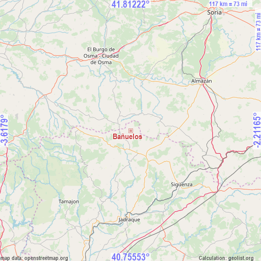
Bañuelos GPS coordinates[2]
41° 17' 9.636" North, 2° 54' 53.172" West
| Map corner | latitude | longitude |
|---|---|---|
| Upper-left | 41.81222°, | -3.6179° |
| Center: | 41.28601°, | -2.91477° |
| Lower-right: | 40.75553°, | -2.21165° |
| Map W x H: | 117.5×117.5 km | = 73×73mi |
| max Lat: | 43.74134° ⇑44.9% North |
| Bañuelos: | 41.28601° |
| min Lat: | ⇓55.1% South 27.64134° |
| min Long | Bañuelos | max Long |
| -18.00367° | -2.91477° | 4.2899° |
| W 55.8%⇐ | ⇒44.2% E |
Elevation
Elevation of Bañuelos is 1148 m = 3766 ft, and this is 550 m = 1804 ft above average elevation for this country.
| Max E: |
1682 m = 5518 ft | 4.6% |
| Bañuelos | 1148 m 3766 ft | |
| Avg. | 598 m = 1962 ft | |
Min E: |
0 m = 0 ft | 95.4% |
See also: Spain elevation on elevation.city.
Geographical zone
Bañuelos is located in North temperate zone (between Tropic of Cancer and the Arctic Circle). Distance of this Northern Tropic circle is 1984.7 km =1233.2 mi to South.| Distance of | km | miles | from Bañuelos |
|---|---|---|---|
| North Pole | 5416.5 | 3365.7 | to North |
| Arctic Circle | 2810.6 | 1746.4 | to North |
| Tropic Cancer | 1984.7 | 1233.2 | to South |
| Equator | 4590.6 | 2852.5 | to South |


Nearby cities:
15 places around Bañuelos: (largest is in red/bold)
• Albendiego
13.2 km =8.2 mi,  240°
240°
• Alcolea de las Peñas
13.8 km =8.6 mi,  128°
128°
• Arenillas
8.9 km =5.5 mi,  40°
40°
• Atienza
10.5 km =6.5 mi,  159°
159°
• Barcones
8.2 km =5.1 mi,  85°
85°
• Cincovillas
12.1 km =7.5 mi,  138°
138°
• Hijes
8.1 km =5 mi, 241°
• Miedes de Atienza
4.6 km =2.9 mi, 242°
• Prádena de Atienza
14.8 km =9.2 mi,  211°
211°
• Rello
14.8 km =9.2 mi,  69°
69°
• Retortillo de Soria
6.3 km =3.9 mi,  296°
296°
• Romanillos de Atienza
2.5 km =1.6 mi,  150°
150°
• Somolinos
12.9 km =8 mi,  249°
249°
• Tordelrábano
15.1 km =9.4 mi,  119°
119°
• Ujados
9.4 km =5.8 mi,  233°
233°
Sources, notices
• [Note1] Compared only with cities in Spain existing in our database
• [Src1] Map data: © OpenStreetMap contributors (CC-BY-SA)
• [Src2] Other city data from geonames.org with taken over terms of usage.
• [Src3] Geographical zone / Annual Mean Temperature by Robert A. Rohde @ Wikipedia
