Cespedosa geodata
Cespedosa (Castille and León) is a populated place; located in Spain in Europe/Madrid (GMT+2) time zone. With population of 578 people, there are 3665 cities with bigger population in this country. Compared to other cities in Spain, 61% of cities are located further ↑North; 79.8% of cities are located further →East and 90.1% of cities have lower elevation than Cespedosa. Note1
Administrative division(s):
- Level 1: Castille and León
- Level 2: Provincia de Salamanca
- Level 3: Cespedosa de Tormes


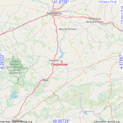
Cespedosa GPS coordinates[2]
40° 32' 37.392" North, 5° 34' 48.36" West
| Map corner | latitude | longitude |
|---|---|---|
| Upper-left | 41.0759°, | -6.28322° |
| Center: | 40.54372°, | -5.5801° |
| Lower-right: | 40.00728°, | -4.87697° |
| Map W x H: | 118.8×118.8 km | = 73.8×73.8mi |
| max Lat: | 43.74134° ⇑61% North |
| Cespedosa: | 40.54372° |
| min Lat: | ⇓39% South 27.64134° |
| min Long | Cespedosa | max Long |
| -18.00367° | -5.5801° | 4.2899° |
| W 20.2%⇐ | ⇒79.8% E |
Elevation
Elevation of Cespedosa is 1033 m = 3389 ft, and this is 435 m = 1427 ft above average elevation for this country.
| Max E: |
1682 m = 5518 ft | 9.9% |
| Cespedosa | 1033 m 3389 ft | |
| Avg. | 598 m = 1962 ft | |
Min E: |
0 m = 0 ft | 90.1% |
See also: Spain elevation on elevation.city.
Geographical zone
Cespedosa is located in North temperate zone (between Tropic of Cancer and the Arctic Circle). Distance of this Northern Tropic circle is 1902.1 km =1181.9 mi to South.| Distance of | km | miles | from Cespedosa |
|---|---|---|---|
| North Pole | 5499 | 3416.9 | to North |
| Arctic Circle | 2893.1 | 1797.7 | to North |
| Tropic Cancer | 1902.1 | 1181.9 | to South |
| Equator | 4508 | 2801.1 | to South |


Nearby cities:
15 places around Cespedosa: (largest is in red/bold)
• Aldeavieja de Tormes
5.4 km =3.4 mi,  324°
324°
• Armenteros
12.4 km =7.7 mi,  63°
63°
• Fuentes de Béjar
10.3 km =6.4 mi,  247°
247°
• Guijo de Ávila
5.2 km =3.2 mi, 254°
• Guijuelo
7.8 km =4.8 mi,  281°
281°
• Medinilla
12 km =7.5 mi,  195°
195°
• Montejo
10.5 km =6.5 mi,  339°
339°
• Narrillos del Álamo
10 km =6.2 mi,  75°
75°
• Nava de Béjar
11.3 km =7 mi,  227°
227°
• Navamorales
11.4 km =7.1 mi,  131°
131°
• Pelayos
11.8 km =7.3 mi,  1°
1°
• Pizarral
10 km =6.2 mi, 322°
• Puente del Congosto
7.5 km =4.7 mi,  142°
142°
• Salvatierra de Tormes
5.4 km =3.4 mi, 343°
• Santibáñez de Béjar
6.7 km =4.2 mi, 202°
Sources, notices
• [Note1] Compared only with cities in Spain existing in our database
• [Src1] Map data: © OpenStreetMap contributors (CC-BY-SA)
• [Src2] Other city data from geonames.org with taken over terms of usage.
• [Src3] Geographical zone / Annual Mean Temperature by Robert A. Rohde @ Wikipedia
