Boceguillas geodata
Boceguillas (Castille and León) is a seat of a third-order administrative division; located in Spain in Europe/Madrid (GMT+2) time zone. With population of 678 people, there are 3440 cities with bigger population in this country. Compared to other cities in Spain, 56% of cities are located further ↓South; 54.4% of cities are located further →East and 86% of cities have lower elevation than Boceguillas. Note1
Administrative division(s):
- Level 1: Castille and León
- Level 2: Provincia de Segovia
- Level 3: Boceguillas


Boceguillas GPS coordinates[2]
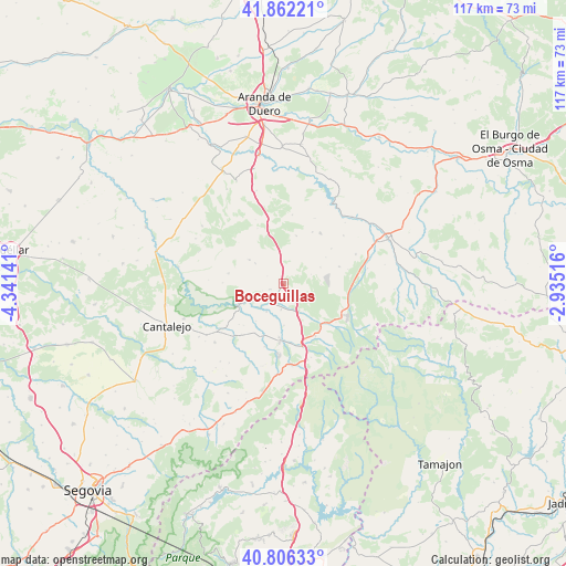
41° 20' 11.076" North, 3° 38' 17.808" West
| Map corner | latitude | longitude |
|---|---|---|
| Upper-left | 41.86221°, | -4.34141° |
| Center: | 41.33641°, | -3.63828° |
| Lower-right: | 40.80633°, | -2.93516° |
| Map W x H: | 117.4×117.4 km | = 72.9×72.9mi |
| max Lat: | 43.74134° ⇑44% North |
| Boceguillas: | 41.33641° |
| min Lat: | ⇓56% South 27.64134° |
| min Long | Boceguillas | max Long |
| -18.00367° | -3.63828° | 4.2899° |
| W 45.6%⇐ | ⇒54.4% E |
Elevation
Elevation of Boceguillas is 963 m = 3159 ft, and this is 365 m = 1198 ft above average elevation for this country.
| Max E: |
1682 m = 5518 ft | 14% |
| Boceguillas | 963 m 3159 ft | |
| Avg. | 598 m = 1962 ft | |
Min E: |
0 m = 0 ft | 86% |
See also: Spain elevation on elevation.city.
Geographical zone
Boceguillas is located in North temperate zone (between Tropic of Cancer and the Arctic Circle). Distance of this Northern Tropic circle is 1990.3 km =1236.7 mi to South.| Distance of | km | miles | from Boceguillas |
|---|---|---|---|
| North Pole | 5410.9 | 3362.2 | to North |
| Arctic Circle | 2805 | 1742.9 | to North |
| Tropic Cancer | 1990.3 | 1236.7 | to South |
| Equator | 4596.2 | 2855.9 | to South |


Nearby cities:
15 places around Boceguillas: (largest is in red/bold)
• Aldeonte
3.7 km =2.3 mi,  295°
295°
• Barbolla
3.2 km =2 mi,  247°
247°
• Bercimuel
9 km =5.6 mi,  38°
38°
• Castillejo de Mesleón
6.9 km =4.3 mi,  153°
153°
• Cedillo de la Torre
10.2 km =6.3 mi,  15°
15°
• Duruelo
11.2 km =7 mi,  184°
184°
• Encinas
5 km =3.1 mi,  330°
330°
• Fresno de la Fuente
6.3 km =3.9 mi,  354°
354°
• Grajera
4.6 km =2.9 mi,  27°
27°
• Navares de Ayuso
7.2 km =4.5 mi,  306°
306°
• Navares de Enmedio
8.6 km =5.3 mi, 305°
• Pajarejos
7.2 km =4.5 mi, 34°
• Sepúlveda
9.7 km =6 mi,  243°
243°
• Sequera de Fresno
8.4 km =5.2 mi,  66°
66°
• Sotillo
8.7 km =5.4 mi, 179°
Sources, notices
• [Note1] Compared only with cities in Spain existing in our database
• [Src1] Map data: © OpenStreetMap contributors (CC-BY-SA)
• [Src2] Other city data from geonames.org with taken over terms of usage.
• [Src3] Geographical zone / Annual Mean Temperature by Robert A. Rohde @ Wikipedia
