Cantiveros geodata
Cantiveros (Castille and León) is a seat of a third-order administrative division; located in Spain in Europe/Madrid (GMT+2) time zone. With population of 183 people, there are 5165 cities with bigger population in this country. Compared to other cities in Spain, 52.8% of cities are located further ↑North; 71.8% of cities are located further →East and 78% of cities have lower elevation than Cantiveros. Note1
Administrative division(s):
- Level 1: Castille and León
- Level 2: Provincia de Ávila
- Level 3: Cantiveros


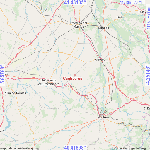
Cantiveros GPS coordinates[2]
40° 57' 7.74" North, 4° 57' 16.38" West
| Map corner | latitude | longitude |
|---|---|---|
| Upper-left | 41.48105°, | -5.65768° |
| Center: | 40.95215°, | -4.95455° |
| Lower-right: | 40.41898°, | -4.25143° |
| Map W x H: | 118.1×118.1 km | = 73.4×73.4mi |
| max Lat: | 43.74134° ⇑52.8% North |
| Cantiveros: | 40.95215° |
| min Lat: | ⇓47.2% South 27.64134° |
| min Long | Cantiveros | max Long |
| -18.00367° | -4.95455° | 4.2899° |
| W 28.2%⇐ | ⇒71.8% E |
Elevation
Elevation of Cantiveros is 879 m = 2884 ft, and this is 281 m = 922 ft above average elevation for this country.
| Max E: |
1682 m = 5518 ft | 22% |
| Cantiveros | 879 m 2884 ft | |
| Avg. | 598 m = 1962 ft | |
Min E: |
0 m = 0 ft | 78% |
See also: Spain elevation on elevation.city.
Geographical zone
Cantiveros is located in North temperate zone (between Tropic of Cancer and the Arctic Circle). Distance of this Northern Tropic circle is 1947.5 km =1210.1 mi to South.| Distance of | km | miles | from Cantiveros |
|---|---|---|---|
| North Pole | 5453.6 | 3388.7 | to North |
| Arctic Circle | 2847.7 | 1769.5 | to North |
| Tropic Cancer | 1947.5 | 1210.1 | to South |
| Equator | 4553.5 | 2829.4 | to South |


Nearby cities:
15 places around Cantiveros: (largest is in red/bold)
• Bercial de Zapardiel
10.6 km =6.6 mi,  353°
353°
• Cabezas de Alambre
9.5 km =5.9 mi,  96°
96°
• Cabezas del Pozo
5.5 km =3.4 mi,  0°
0°
• Canales
7.2 km =4.5 mi,  37°
37°
• Cisla
5.2 km =3.2 mi,  287°
287°
• Collado de Contreras
7.5 km =4.7 mi,  164°
164°
• Constanzana
6.8 km =4.2 mi, 103°
• Crespos
9.1 km =5.7 mi,  188°
188°
• Donjimeno
9.1 km =5.7 mi,  84°
84°
• Fontiveros
2.6 km =1.6 mi,  198°
198°
• Fuentes de Año
8.6 km =5.3 mi,  32°
32°
• Langa
9.9 km =6.2 mi,  53°
53°
• Mamblas
8.7 km =5.4 mi,  328°
328°
• Muñosancho
7.6 km =4.7 mi,  243°
243°
• Rivilla de Barajas
6.2 km =3.9 mi,  207°
207°
Sources, notices
• [Note1] Compared only with cities in Spain existing in our database
• [Src1] Map data: © OpenStreetMap contributors (CC-BY-SA)
• [Src2] Other city data from geonames.org with taken over terms of usage.
• [Src3] Geographical zone / Annual Mean Temperature by Robert A. Rohde @ Wikipedia
