Cantimpalos geodata
Cantimpalos (Castille and León) is a seat of a third-order administrative division; located in Spain in Europe/Madrid (GMT+2) time zone. With population of 1,297 people, there are 2647 cities with bigger population in this country. Compared to other cities in Spain, 50.3% of cities are located further ↓South; 62% of cities are located further →East and 81.4% of cities have lower elevation than Cantimpalos. Note1
Administrative division(s):
- Level 1: Castille and León
- Level 2: Provincia de Segovia
- Level 3: Cantimpalos


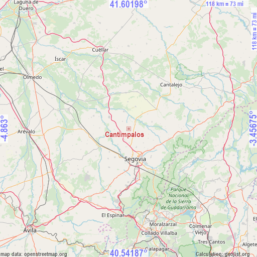
Cantimpalos GPS coordinates[2]
41° 4' 26.616" North, 4° 9' 35.568" West
| Map corner | latitude | longitude |
|---|---|---|
| Upper-left | 41.60198°, | -4.863° |
| Center: | 41.07406°, | -4.15988° |
| Lower-right: | 40.54187°, | -3.45675° |
| Map W x H: | 117.9×117.9 km | = 73.3×73.3mi |
| max Lat: | 43.74134° ⇑49.7% North |
| Cantimpalos: | 41.07406° |
| min Lat: | ⇓50.3% South 27.64134° |
| min Long | Cantimpalos | max Long |
| -18.00367° | -4.15988° | 4.2899° |
| W 38%⇐ | ⇒62% E |
Elevation
Elevation of Cantimpalos is 911 m = 2989 ft, and this is 313 m = 1027 ft above average elevation for this country.
| Max E: |
1682 m = 5518 ft | 18.6% |
| Cantimpalos | 911 m 2989 ft | |
| Avg. | 598 m = 1962 ft | |
Min E: |
0 m = 0 ft | 81.4% |
See also: Spain elevation on elevation.city.
Geographical zone
Cantimpalos is located in North temperate zone (between Tropic of Cancer and the Arctic Circle). Distance of this Northern Tropic circle is 1961.1 km =1218.6 mi to South.| Distance of | km | miles | from Cantimpalos |
|---|---|---|---|
| North Pole | 5440.1 | 3380.3 | to North |
| Arctic Circle | 2834.2 | 1761.1 | to North |
| Tropic Cancer | 1961.1 | 1218.6 | to South |
| Equator | 4567 | 2837.8 | to South |


Nearby cities:
15 places around Cantimpalos: (largest is in red/bold)
• Adrada de Pirón
9.4 km =5.8 mi,  104°
104°
• Brieva
9.9 km =6.2 mi,  116°
116°
• Cabañas de Polendos
4.3 km =2.7 mi, 101°
• Carbonero el Mayor
10.3 km =6.4 mi,  301°
301°
• Encinillas
6.2 km =3.9 mi,  178°
178°
• Escalona del Prado
10.8 km =6.7 mi,  16°
16°
• Escarabajosa de Cabezas
4.5 km =2.8 mi,  319°
319°
• Escobar de Polendos
3 km =1.9 mi,  52°
52°
• Hontanares de Eresma
10.8 km =6.7 mi,  200°
200°
• Mozoncillo
8.3 km =5.2 mi,  343°
343°
• Roda de Eresma
5.4 km =3.4 mi, 199°
• Tabanera la Luenga
7.1 km =4.4 mi,  290°
290°
• Torreiglesias
11.1 km =6.9 mi,  73°
73°
• Valseca
8.4 km =5.2 mi,  188°
188°
• Yanguas de Eresma
6.6 km =4.1 mi,  268°
268°
Sources, notices
• [Note1] Compared only with cities in Spain existing in our database
• [Src1] Map data: © OpenStreetMap contributors (CC-BY-SA)
• [Src2] Other city data from geonames.org with taken over terms of usage.
• [Src3] Geographical zone / Annual Mean Temperature by Robert A. Rohde @ Wikipedia
