Yanguas de Eresma geodata
Yanguas de Eresma (Castille and León) is a seat of a third-order administrative division; located in Spain in Europe/Madrid (GMT+2) time zone. With population of 202 people, there are 5026 cities with bigger population in this country. Compared to other cities in Spain, 50.2% of cities are located further ↓South; 63.1% of cities are located further →East and 79.8% of cities have lower elevation than Yanguas de Eresma. Note1
Administrative division(s):
- Level 1: Castille and León
- Level 2: Provincia de Segovia
- Level 3: Yanguas de Eresma


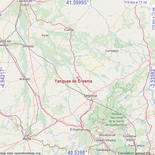
Yanguas de Eresma GPS coordinates[2]
41° 4' 19.236" North, 4° 14' 20.58" West
| Map corner | latitude | longitude |
|---|---|---|
| Upper-left | 41.59995°, | -4.94217° |
| Center: | 41.07201°, | -4.23905° |
| Lower-right: | 40.5398°, | -3.53592° |
| Map W x H: | 117.9×117.9 km | = 73.3×73.3mi |
| max Lat: | 43.74134° ⇑49.8% North |
| Yanguas de Eresma: | 41.07201° |
| min Lat: | ⇓50.2% South 27.64134° |
| min Long | Yanguas de Eres | max Long |
| -18.00367° | -4.23905° | 4.2899° |
| W 36.9%⇐ | ⇒63.1% E |
Elevation
Elevation of Yanguas de Eresma is 895 m = 2936 ft, and this is 297 m = 974 ft above average elevation for this country.
| Max E: |
1682 m = 5518 ft | 20.2% |
| Yanguas de Eresma | 895 m 2936 ft | |
| Avg. | 598 m = 1962 ft | |
Min E: |
0 m = 0 ft | 79.8% |
See also: Spain elevation on elevation.city.
Geographical zone
Yanguas de Eresma is located in North temperate zone (between Tropic of Cancer and the Arctic Circle). Distance of this Northern Tropic circle is 1960.9 km =1218.4 mi to South.| Distance of | km | miles | from Yanguas de Eresma |
|---|---|---|---|
| North Pole | 5440.3 | 3380.4 | to North |
| Arctic Circle | 2834.4 | 1761.2 | to North |
| Tropic Cancer | 1960.9 | 1218.4 | to South |
| Equator | 4566.8 | 2837.7 | to South |


Nearby cities:
15 places around Yanguas de Eresma: (largest is in red/bold)
• Anaya
10.7 km =6.6 mi,  213°
213°
• Armuña
6.8 km =4.2 mi,  274°
274°
• Añe
6.1 km =3.8 mi,  230°
230°
• Cabañas de Polendos
10.8 km =6.7 mi,  93°
93°
• Cantimpalos
6.6 km =4.1 mi, 88°
• Carbonero el Mayor
6 km =3.7 mi,  339°
339°
• Encinillas
9.1 km =5.7 mi,  131°
131°
• Escarabajosa de Cabezas
5.2 km =3.2 mi,  46°
46°
• Escobar de Polendos
9.3 km =5.8 mi,  76°
76°
• Garcillán
10.7 km =6.6 mi,  192°
192°
• Hontanares de Eresma
10.3 km =6.4 mi,  163°
163°
• Mozoncillo
9.2 km =5.7 mi,  27°
27°
• Roda de Eresma
6.8 km =4.2 mi, 134°
• Tabanera la Luenga
2.7 km =1.7 mi,  359°
359°
• Valseca
9.7 km =6 mi,  146°
146°
Sources, notices
• [Note1] Compared only with cities in Spain existing in our database
• [Src1] Map data: © OpenStreetMap contributors (CC-BY-SA)
• [Src2] Other city data from geonames.org with taken over terms of usage.
• [Src3] Geographical zone / Annual Mean Temperature by Robert A. Rohde @ Wikipedia
