Bogajo geodata
Bogajo (Castille and León) is a seat of a third-order administrative division; located in Spain in Europe/Madrid (GMT+2) time zone. With population of 194 people, there are 5078 cities with bigger population in this country. Compared to other cities in Spain, 53.7% of cities are located further ↑North; 91.4% of cities are located further →East and 55.9% of cities have lower elevation than Bogajo. Note1
Administrative division(s):
- Level 1: Castille and León
- Level 2: Provincia de Salamanca
- Level 3: Bogajo


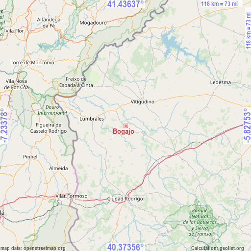
Bogajo GPS coordinates[2]
40° 54' 25.56" North, 6° 31' 50.34" West
| Map corner | latitude | longitude |
|---|---|---|
| Upper-left | 41.43637°, | -7.23378° |
| Center: | 40.9071°, | -6.53065° |
| Lower-right: | 40.37356°, | -5.82753° |
| Map W x H: | 118.2×118.2 km | = 73.4×73.4mi |
| max Lat: | 43.74134° ⇑53.7% North |
| Bogajo: | 40.9071° |
| min Lat: | ⇓46.3% South 27.64134° |
| min Long | Bogajo | max Long |
| -18.00367° | -6.53065° | 4.2899° |
| W 8.6%⇐ | ⇒91.4% E |
Elevation
Elevation of Bogajo is 715 m = 2346 ft, and this is 117 m = 384 ft above average elevation for this country.
| Max E: |
1682 m = 5518 ft | 44.1% |
| Bogajo | 715 m 2346 ft | |
| Avg. | 598 m = 1962 ft | |
Min E: |
0 m = 0 ft | 55.9% |
See also: Spain elevation on elevation.city.
Geographical zone
Bogajo is located in North temperate zone (between Tropic of Cancer and the Arctic Circle). Distance of this Northern Tropic circle is 1942.5 km =1207 mi to South.| Distance of | km | miles | from Bogajo |
|---|---|---|---|
| North Pole | 5458.6 | 3391.8 | to North |
| Arctic Circle | 2852.7 | 1772.6 | to North |
| Tropic Cancer | 1942.5 | 1207 | to South |
| Equator | 4548.4 | 2826.2 | to South |


Nearby cities:
15 places around Bogajo: (largest is in red/bold)
• Bañobárez
9.5 km =5.9 mi,  226°
226°
• Bermellar
15.6 km =9.7 mi,  311°
311°
• Cerralbo
8.8 km =5.5 mi,  327°
327°
• Encinasola de los Comendadores
13.8 km =8.6 mi,  359°
359°
• Guadramiro
12.6 km =7.8 mi,  14°
14°
• Lumbrales
16.2 km =10.1 mi,  281°
281°
• Moronta
11.4 km =7.1 mi,  47°
47°
• Olmedo de Camaces
8.4 km =5.2 mi,  248°
248°
• Pozos de Hinojo
10 km =6.2 mi,  86°
86°
• Saldeana
15.6 km =9.7 mi,  323°
323°
• San Felices de los Gallegos
16.2 km =10.1 mi, 246°
• Villares de Yeltes
10.9 km =6.8 mi,  114°
114°
• Villavieja de Yeltes
6.3 km =3.9 mi,  123°
123°
• Vitigudino
13.9 km =8.6 mi,  35°
35°
• Yecla de Yeltes
6.8 km =4.2 mi,  31°
31°
Sources, notices
• [Note1] Compared only with cities in Spain existing in our database
• [Src1] Map data: © OpenStreetMap contributors (CC-BY-SA)
• [Src2] Other city data from geonames.org with taken over terms of usage.
• [Src3] Geographical zone / Annual Mean Temperature by Robert A. Rohde @ Wikipedia
