Bielsa geodata
Bielsa (Aragon) is a seat of a third-order administrative division; located in Spain in Europe/Madrid (GMT+2) time zone. With population of 462 people, there are 3978 cities with bigger population in this country. Compared to other cities in Spain, 90.3% of cities are located further ↓South; 88% of cities are located further ←West and 90.2% of cities have lower elevation than Bielsa. Note1


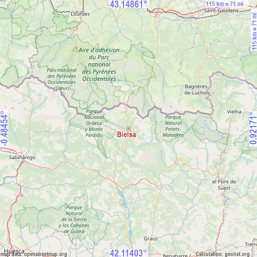
Bielsa GPS coordinates[2]
42° 38' 0.492" North, 0° 13' 6.888" East
| Map corner | latitude | longitude |
|---|---|---|
| Upper-left | 43.14861°, | -0.48454° |
| Center: | 42.63347°, | 0.21858° |
| Lower-right: | 42.11403°, | 0.92171° |
| Map W x H: | 115×115 km | = 71.5×71.5mi |
| max Lat: | 43.74134° ⇑9.7% North |
| Bielsa: | 42.63347° |
| min Lat: | ⇓90.3% South 27.64134° |
| min Long | Bielsa | max Long |
| -18.00367° | 0.21858° | 4.2899° |
| W 88%⇐ | ⇒12% E |
Elevation
Elevation of Bielsa is 1034 m = 3392 ft, and this is 436 m = 1430 ft above average elevation for this country.
| Max E: |
1682 m = 5518 ft | 9.8% |
| Bielsa | 1034 m 3392 ft | |
| Avg. | 598 m = 1962 ft | |
Min E: |
0 m = 0 ft | 90.2% |
See also: Spain elevation on elevation.city.
Geographical zone
Bielsa is located in North temperate zone (between Tropic of Cancer and the Arctic Circle). Distance of this Northern Tropic circle is 2134.5 km =1326.3 mi to South.| Distance of | km | miles | from Bielsa |
|---|---|---|---|
| North Pole | 5266.7 | 3272.6 | to North |
| Arctic Circle | 2660.8 | 1653.3 | to North |
| Tropic Cancer | 2134.5 | 1326.3 | to South |
| Equator | 4740.4 | 2945.5 | to South |


Nearby cities:
15 places around Bielsa: (largest is in red/bold)
• Aínsa
25.1 km =15.6 mi,  194°
194°
• Benasque
25.1 km =15.6 mi,  97°
97°
• Bisaurri
28.1 km =17.5 mi,  122°
122°
• Boltaña
24.3 km =15.1 mi,  210°
210°
• Castejón de Sos
26.2 km =16.3 mi, 120°
• Chía
23.8 km =14.8 mi, 121°
• Gistaín
10.6 km =6.6 mi, 116°
• Labuerda
21.3 km =13.2 mi,  198°
198°
• Laspuña
15.4 km =9.6 mi, 200°
• Plan
11.3 km =7 mi, 120°
• Puértolas
11.9 km =7.4 mi,  216°
216°
• Sahún
21.2 km =13.2 mi,  107°
107°
• Seira
24.6 km =15.3 mi,  134°
134°
• Sesué
22.7 km =14.1 mi, 113°
• Villanova
22.1 km =13.7 mi, 115°
Sources, notices
• [Note1] Compared only with cities in Spain existing in our database
• [Src1] Map data: © OpenStreetMap contributors (CC-BY-SA)
• [Src2] Other city data from geonames.org with taken over terms of usage.
• [Src3] Geographical zone / Annual Mean Temperature by Robert A. Rohde @ Wikipedia
