Barjas geodata
Barjas (Castille and León) is a seat of a third-order administrative division; located in Spain in Europe/Madrid (GMT+2) time zone. With population of 355 people, there are 4297 cities with bigger population in this country. Compared to other cities in Spain, 89.8% of cities are located further ↓South; 94.2% of cities are located further →East and 74.2% of cities have lower elevation than Barjas. Note1


Barjas GPS coordinates[2]
42° 36' 42.552" North, 6° 58' 47.244" West
| Map corner | latitude | longitude |
|---|---|---|
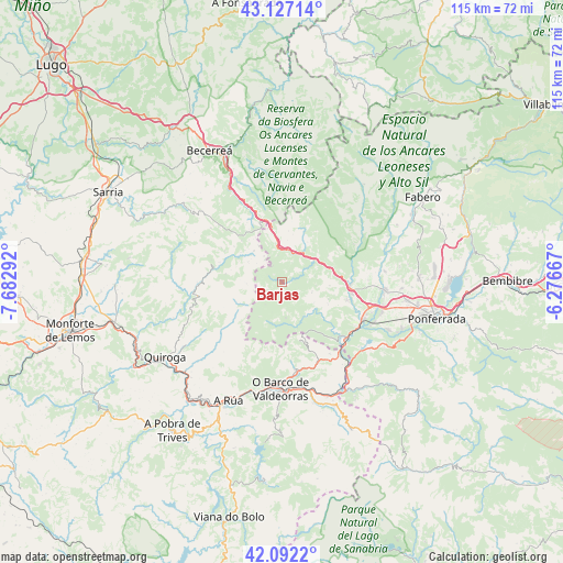
| Upper-left | 43.12714°, | -7.68292° |
| Center: | 42.61182°, | -6.97979° |
| Lower-right: | 42.0922°, | -6.27667° |
| Map W x H: | 115.1×115.1 km | = 71.5×71.5mi |
| max Lat: | 43.74134° ⇑10.2% North |
| Barjas: | 42.61182° |
| min Lat: | ⇓89.8% South 27.64134° |
| min Long | Barjas | max Long |
| -18.00367° | -6.97979° | 4.2899° |
| W 5.8%⇐ | ⇒94.2% E |
Elevation
Elevation of Barjas is 845 m = 2772 ft, and this is 247 m = 810 ft above average elevation for this country.
| Max E: |
1682 m = 5518 ft | 25.8% |
| Barjas | 845 m 2772 ft | |
| Avg. | 598 m = 1962 ft | |
Min E: |
0 m = 0 ft | 74.2% |
See also: Spain elevation on elevation.city.
Geographical zone
Barjas is located in North temperate zone (between Tropic of Cancer and the Arctic Circle). Distance of this Northern Tropic circle is 2132.1 km =1324.8 mi to South.| Distance of | km | miles | from Barjas |
|---|---|---|---|
| North Pole | 5269.1 | 3274.1 | to North |
| Arctic Circle | 2663.2 | 1654.8 | to North |
| Tropic Cancer | 2132.1 | 1324.8 | to South |
| Equator | 4738 | 2944.1 | to South |


Nearby cities:
15 places around Barjas: (largest is in red/bold)
• A Rúa
25.6 km =15.9 mi,  203°
203°
• Arganza
24.2 km =15 mi,  82°
82°
• Balboa
11.5 km =7.1 mi,  24°
24°
• Borrenes
25 km =15.5 mi,  122°
122°
• Cacabelos
21 km =13 mi,  93°
93°
• Carracedelo
21.1 km =13.1 mi,  107°
107°
• Carucedo
22.1 km =13.7 mi,  127°
127°
• Corullón
13.6 km =8.5 mi, 105°
• O Barco de Valdeorras
21.7 km =13.5 mi,  182°
182°
• Oencia
7.2 km =4.5 mi,  172°
172°
• Sobrado
15 km =9.3 mi, 134°
• Trabadelo
9.1 km =5.7 mi,  63°
63°
• Vega de Valcarce
6.4 km =4 mi,  32°
32°
• Villadecanes
18.4 km =11.4 mi,  101°
101°
• Villafranca del Bierzo
13.9 km =8.6 mi, 92°
Sources, notices
• [Note1] Compared only with cities in Spain existing in our database
• [Src1] Map data: © OpenStreetMap contributors (CC-BY-SA)
• [Src2] Other city data from geonames.org with taken over terms of usage.
• [Src3] Geographical zone / Annual Mean Temperature by Robert A. Rohde @ Wikipedia
