Sant Antoni geodata
Sant Antoni (Catalonia) is a section of populated place; located in Spain in Europe/Madrid (GMT+2) time zone. With population of 38,512 people, there are 231 cities with bigger population in this country. Compared to other cities in Spain, 57% of cities are located further ↓South; 94.5% of cities are located further ←West and 93.4% of cities have higher elevation than Sant Antoni. Note1
Administrative division(s):
- Level 1: Catalonia
- Level 2: Província de Barcelona
- Level 3: Barcelona
- Level 4: Eixample


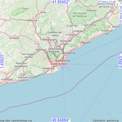
Sant Antoni GPS coordinates[2]
41° 22' 42.852" North, 2° 9' 33.732" East
| Map corner | latitude | longitude |
|---|---|---|
| Upper-left | 41.90402°, | 1.45625° |
| Center: | 41.37857°, | 2.15937° |
| Lower-right: | 40.84884°, | 2.8625° |
| Map W x H: | 117.3×117.3 km | = 72.9×72.9mi |
| max Lat: | 43.74134° ⇑43% North |
| Sant Antoni: | 41.37857° |
| min Lat: | ⇓57% South 27.64134° |
| min Long | Sant Antoni | max Long |
| -18.00367° | 2.15937° | 4.2899° |
| W 94.5%⇐ | ⇒5.5% E |
Elevation
Elevation of Sant Antoni is 35 m = 115 ft, and this is 563 m = 1847 ft below average elevation for this country.
| Max E: |
1682 m = 5518 ft | 93.4% |
| Avg. | 598 m = 1962 ft | |
| Sant Antoni | 35 m = 115 ft | |
Min E: |
0 m = 0 ft | 6.6% |
See also: Spain elevation on elevation.city.
Geographical zone
Sant Antoni is located in North temperate zone (between Tropic of Cancer and the Arctic Circle). Distance of this Northern Tropic circle is 1994.9 km =1239.6 mi to South.| Distance of | km | miles | from Sant Antoni |
|---|---|---|---|
| North Pole | 5406.2 | 3359.3 | to North |
| Arctic Circle | 2800.3 | 1740 | to North |
| Tropic Cancer | 1994.9 | 1239.6 | to South |
| Equator | 4600.9 | 2858.9 | to South |


Nearby cities:
15 places around Sant Antoni: (largest is in red/bold)
• Barcelona
1.1 km =0.7 mi,  358°
358°
• Barri Gòtic
1.5 km =0.9 mi,  68°
68°
• Ciutat Vella
1.2 km =0.7 mi,  80°
80°
• Dreta de l'Eixample
2 km =1.2 mi,  17°
17°
• Eixample
1.2 km =0.7 mi,  9°
9°
• Hostafrancs
1.4 km =0.9 mi,  262°
262°
• La Bordeta
1.4 km =0.9 mi,  248°
248°
• Poble Sec
0.6 km =0.4 mi,  144°
144°
• Sant Pere, Santa Caterina i La Ribera
2 km =1.2 mi, 70°
• Sants
1.8 km =1.1 mi, 254°
• Sants-Montjuïc
0.8 km =0.5 mi,  211°
211°
• el Raval
0.8 km =0.5 mi, 75°
• l'Antiga Esquerra de l'Eixample
1.3 km =0.8 mi,  343°
343°
• la Font de la Guatlla
1.6 km =1 mi,  231°
231°
• la Nova Esquerra de l'Eixample
1 km =0.6 mi,  300°
300°
Sources, notices
• [Note1] Compared only with cities in Spain existing in our database
• [Src1] Map data: © OpenStreetMap contributors (CC-BY-SA)
• [Src2] Other city data from geonames.org with taken over terms of usage.
• [Src3] Geographical zone / Annual Mean Temperature by Robert A. Rohde @ Wikipedia
