la Font d'en Fargues geodata
la Font d'en Fargues (Catalonia) is a section of populated place; located in Spain in Europe/Madrid (GMT+2) time zone. With population of 9,505 people, there are 877 cities with bigger population in this country. Compared to other cities in Spain, 58.7% of cities are located further ↓South; 94.6% of cities are located further ←West and 87.1% of cities have higher elevation than la Font d'en Fargues. Note1
Administrative division(s):
- Level 1: Catalonia
- Level 2: Província de Barcelona
- Level 3: Barcelona
- Level 4: Horta-Guinardó


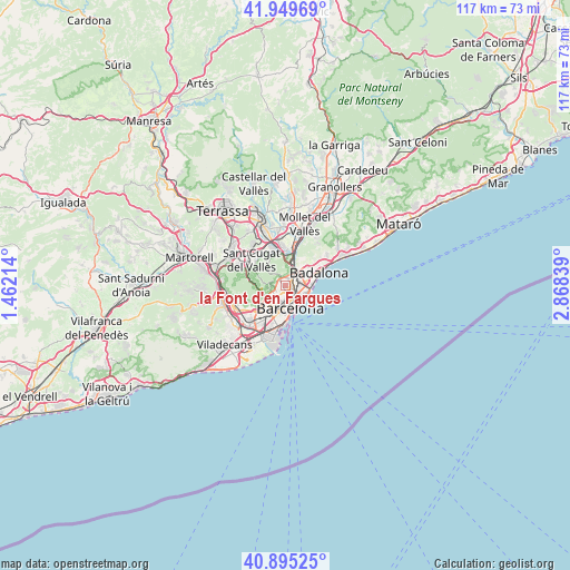
la Font d'en Fargues GPS coordinates[2]
41° 25' 28.596" North, 2° 9' 54.936" East
| Map corner | latitude | longitude |
|---|---|---|
| Upper-left | 41.94969°, | 1.46214° |
| Center: | 41.42461°, | 2.16526° |
| Lower-right: | 40.89525°, | 2.86839° |
| Map W x H: | 117.2×117.2 km | = 72.8×72.8mi |
| max Lat: | 43.74134° ⇑41.3% North |
| la Font d'en Fargues: | 41.42461° |
| min Lat: | ⇓58.7% South 27.64134° |
| min Long | la Font d'en Fa | max Long |
| -18.00367° | 2.16526° | 4.2899° |
| W 94.6%⇐ | ⇒5.4% E |
Elevation
Elevation of la Font d'en Fargues is 109 m = 358 ft, and this is 489 m = 1604 ft below average elevation for this country.
| Max E: |
1682 m = 5518 ft | 87.1% |
| Avg. | 598 m = 1962 ft | |
| la Font d'en Fargues | 109 m = 358 ft | |
Min E: |
0 m = 0 ft | 12.9% |
See also: Spain elevation on elevation.city.
Geographical zone
la Font d'en Fargues is located in North temperate zone (between Tropic of Cancer and the Arctic Circle). Distance of this Northern Tropic circle is 2000.1 km =1242.8 mi to South.| Distance of | km | miles | from la Font d'en Fargues |
|---|---|---|---|
| North Pole | 5401.1 | 3356.1 | to North |
| Arctic Circle | 2795.2 | 1736.9 | to North |
| Tropic Cancer | 2000.1 | 1242.8 | to South |
| Equator | 4606 | 2862 | to South |


Nearby cities:
15 places around la Font d'en Fargues: (largest is in red/bold)
• Can Baró
0.9 km =0.6 mi,  195°
195°
• Can Peguera
1.1 km =0.7 mi,  5°
5°
• El Carmel
0.9 km =0.6 mi,  213°
213°
• Horta
1.5 km =0.9 mi,  332°
332°
• Horta-Guinardó
0.7 km =0.4 mi,  163°
163°
• Porta
1.6 km =1 mi,  44°
44°
• Vilapicina i la Torre Llobeta
0.9 km =0.6 mi,  58°
58°
• el Baix Guinardó
1.4 km =0.9 mi,  171°
171°
• el Congrés i els Indians
1.3 km =0.8 mi,  90°
90°
• el Guinardó
0.9 km =0.6 mi,  132°
132°
• el Turó de la Peira
0.9 km =0.6 mi,  19°
19°
• la Clota
1.1 km =0.7 mi,  295°
295°
• la Guineueta
1.6 km =1 mi, 10°
• la Salut
1.6 km =1 mi, 213°
• la Teixonera
1.6 km =1 mi,  263°
263°
Sources, notices
• [Note1] Compared only with cities in Spain existing in our database
• [Src1] Map data: © OpenStreetMap contributors (CC-BY-SA)
• [Src2] Other city data from geonames.org with taken over terms of usage.
• [Src3] Geographical zone / Annual Mean Temperature by Robert A. Rohde @ Wikipedia
