el Congrés i els Indians geodata
el Congrés i els Indians (Catalonia) is a section of populated place; located in Spain in Europe/Madrid (GMT+2) time zone. With population of 14,161 people, there are 652 cities with bigger population in this country. Compared to other cities in Spain, 58.7% of cities are located further ↓South; 95% of cities are located further ←West and 91.1% of cities have higher elevation than el Congrés i els Indians. Note1
Administrative division(s):
- Level 1: Catalonia
- Level 2: Província de Barcelona
- Level 3: Barcelona
- Level 4: Sant Andreu
Current local time in el Congrés i els Indians:
10:39 PM, ThursdayDifference from your time zone: hours


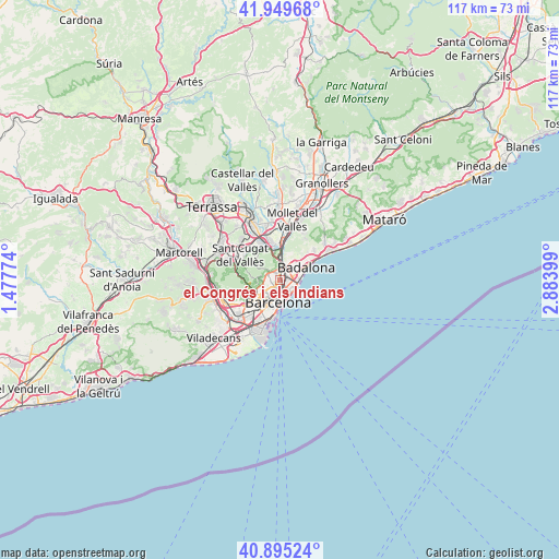
el Congrés i els Indians GPS coordinates[2]
41° 25' 28.56" North, 2° 10' 51.096" East
| Map corner | latitude | longitude |
|---|---|---|
| Upper-left | 41.94968°, | 1.47774° |
| Center: | 41.4246°, | 2.18086° |
| Lower-right: | 40.89524°, | 2.88399° |
| Map W x H: | 117.2×117.2 km | = 72.8×72.8mi |
| max Lat: | 43.74134° ⇑41.3% North |
| el Congrés i els Indians: | 41.4246° |
| min Lat: | ⇓58.7% South 27.64134° |
| min Long | el Congrés i e | max Long |
| -18.00367° | 2.18086° | 4.2899° |
| W 95%⇐ | ⇒5% E |
Elevation
Elevation of el Congrés i els Indians is 51 m = 167 ft, and this is 547 m = 1795 ft below average elevation for this country.
| Max E: |
1682 m = 5518 ft | 91.1% |
| Avg. | 598 m = 1962 ft | |
| el Congrés i els Indians | 51 m = 167 ft | |
Min E: |
0 m = 0 ft | 8.9% |
See also: Spain elevation on elevation.city.
Geographical zone
el Congrés i els Indians is located in North temperate zone (between Tropic of Cancer and the Arctic Circle). Distance of this Northern Tropic circle is 2000.1 km =1242.8 mi to South.| Distance of | km | miles | from el Congrés i els Indians |
|---|---|---|---|
| North Pole | 5401.1 | 3356.1 | to North |
| Arctic Circle | 2795.2 | 1736.9 | to North |
| Tropic Cancer | 2000.1 | 1242.8 | to South |
| Equator | 4606 | 2862 | to South |


Nearby cities:
15 places around el Congrés i els Indians: (largest is in red/bold)
• Barri de Sant Andreu
1.6 km =1 mi,  29°
29°
• Can Peguera
1.7 km =1.1 mi,  313°
313°
• Horta-Guinardó
1.3 km =0.8 mi,  238°
238°
• La Sagrera
0.5 km =0.3 mi,  116°
116°
• Navas
0.8 km =0.5 mi,  149°
149°
• Porta
1.2 km =0.7 mi,  351°
351°
• Sant Andreu
1.4 km =0.9 mi, 31°
• Sant Martí
1.7 km =1.1 mi, 115°
• Sant Martí de Provençals
1.4 km =0.9 mi,  110°
110°
• Vilapicina i la Torre Llobeta
0.7 km =0.4 mi, 308°
• el Camp de l'Arpa del Clot
1.4 km =0.9 mi,  174°
174°
• el Clot
1.8 km =1.1 mi, 153°
• el Guinardó
0.9 km =0.6 mi,  223°
223°
• el Turó de la Peira
1.3 km =0.8 mi, 310°
• la Font d'en Fargues
1.3 km =0.8 mi,  270°
270°
Sources, notices
• [Note1] Compared only with cities in Spain existing in our database
• [Src1] Map data: © OpenStreetMap contributors (CC-BY-SA)
• [Src2] Other city data from geonames.org with taken over terms of usage.
• [Src3] Geographical zone / Annual Mean Temperature by Robert A. Rohde @ Wikipedia
