Hietalahti geodata
Hietalahti (Ostrobothnia) is a section of populated place; located in Finland in Europe/Helsinki (GMT+3) time zone. With population of 4,700 people, there are 222 cities with bigger population in this country. Compared to other cities in Finland, 72.4% of cities are located further ↓South; 96.6% of cities are located further →East and 98.3% of cities have higher elevation than Hietalahti. Note1


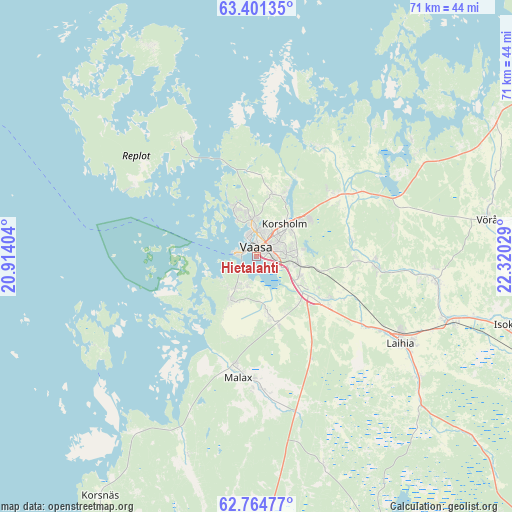
Hietalahti GPS coordinates[2]
63° 5' 5.28" North, 21° 37' 1.776" East
| Map corner | latitude | longitude |
|---|---|---|
| Upper-left | 63.40135°, | 20.91404° |
| Center: | 63.0848°, | 21.61716° |
| Lower-right: | 62.76477°, | 22.32029° |
| Map W x H: | 70.8×70.8 km | = 44×44mi |
| max Lat: | 69.90864° ⇑27.6% North |
| Hietalahti: | 63.0848° |
| min Lat: | ⇓72.4% South 59.83333° |
| min Long | Hietalahti | max Long |
| 21.2° | 21.61716° | 30.93276° |
| W 3.4%⇐ | ⇒96.6% E |
Elevation
Elevation of Hietalahti is 2 m = 7 ft, and this is 75.1 m = 246 ft below average elevation for this country.
| Max E: |
299 m = 981 ft | 98.3% |
| Avg. | 77.1 m = 253 ft | |
| Hietalahti | 2 m = 7 ft | |
Min E: |
1 m = 3 ft | 1.7% |
See also: Finland elevation on elevation.city.
Geographical zone
Hietalahti is located in North temperate zone (between Tropic of Cancer and the Arctic Circle). Distance of this North polar circle is 386.8 km =240.3 mi to North.| Distance of | km | miles | from Hietalahti |
|---|---|---|---|
| North Pole | 2992.7 | 1859.6 | to North |
| Arctic Circle | 386.8 | 240.3 | to North |
| Tropic Cancer | 4408.5 | 2739.3 | to South |
| Equator | 7014.4 | 4358.5 | to South |


Nearby cities:
15 places around Hietalahti: (largest is in red/bold)
• Isokyrö
37 km =23 mi,  102°
102°
• Jurva
48.3 km =30 mi,  157°
157°
• Korsholm
4.6 km =2.9 mi,  45°
45°
• Korsnäs
39.6 km =24.6 mi,  212°
212°
• Laihia
23.3 km =14.5 mi,  121°
121°
• Malax
16 km =9.9 mi,  187°
187°
• Oravais
45.1 km =28 mi,  57°
57°
• Replot
18.9 km =11.7 mi,  327°
327°
• Ristinummi
5.4 km =3.4 mi,  81°
81°
• Smedsby
5.5 km =3.4 mi, 49°
• Teeriniemi
4.2 km =2.6 mi,  71°
71°
• Vaasa
1.2 km =0.7 mi,  356°
356°
• Vähäkyrö
24.8 km =15.4 mi, 97°
• Vörå
32.4 km =20.1 mi, 79°
• Ylistaro
48 km =29.8 mi,  109°
109°
Sources, notices
• [Note1] Compared only with cities in Finland existing in our database
• [Src1] Map data: © OpenStreetMap contributors (CC-BY-SA)
• [Src2] Other city data from geonames.org with taken over terms of usage.
• [Src3] Geographical zone / Annual Mean Temperature by Robert A. Rohde @ Wikipedia
