Vihanti geodata
Vihanti (Northern Ostrobothnia) is a populated place; located in Finland in Europe/Helsinki (GMT+3) time zone. With population of 3,270 people, there are 283 cities with bigger population in this country. Compared to other cities in Finland, 88.9% of cities are located further ↓South; 55.1% of cities are located further ←West and 64.1% of cities have lower elevation than Vihanti. Note1


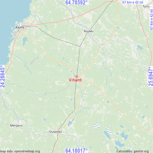
Vihanti GPS coordinates[2]
64° 29' 4.992" North, 24° 59' 29.652" East
| Map corner | latitude | longitude |
|---|---|---|
| Upper-left | 64.78592°, | 24.28845° |
| Center: | 64.48472°, | 24.99157° |
| Lower-right: | 64.18017°, | 25.6947° |
| Map W x H: | 67.4×67.4 km | = 41.9×41.9mi |
| max Lat: | 69.90864° ⇑11.1% North |
| Vihanti: | 64.48472° |
| min Lat: | ⇓88.9% South 59.83333° |
| min Long | Vihanti | max Long |
| 21.2° | 24.99157° | 30.93276° |
| W 55.1%⇐ | ⇒44.9% E |
Elevation
Elevation of Vihanti is 99 m = 325 ft, and this is 21.9 m = 72 ft above average elevation for this country.
| Max E: |
299 m = 981 ft | 35.9% |
| Vihanti | 99 m 325 ft | |
| Avg. | 77.1 m = 253 ft | |
Min E: |
1 m = 3 ft | 64.1% |
See also: Finland elevation on elevation.city.
Geographical zone
Vihanti is located in North temperate zone (between Tropic of Cancer and the Arctic Circle). Distance of this North polar circle is 231.1 km =143.6 mi to North.| Distance of | km | miles | from Vihanti |
|---|---|---|---|
| North Pole | 2837 | 1762.8 | to North |
| Arctic Circle | 231.1 | 143.6 | to North |
| Tropic Cancer | 4564.1 | 2836 | to South |
| Equator | 7170 | 4455.2 | to South |


Nearby cities:
15 places around Vihanti: (largest is in red/bold)
• Alavieska
48.6 km =30.2 mi,  223°
223°
• Haapavesi
43.1 km =26.8 mi,  155°
155°
• Kempele
53.5 km =33.2 mi,  27°
27°
• Liminka
41.4 km =25.7 mi, 29°
• Lumijoki
40.3 km =25 mi,  13°
13°
• Merijärvi
33.2 km =20.6 mi,  231°
231°
• Oulainen
25.9 km =16.1 mi,  200°
200°
• Pulkkila
48.6 km =30.2 mi,  119°
119°
• Pyhäjoki
36.4 km =22.6 mi,  266°
266°
• Raahe
32.8 km =20.4 mi,  312°
312°
• Rantsila
32.3 km =20.1 mi,  85°
85°
• Ruukki
20.9 km =13 mi, 14°
• Siikajoki
38.3 km =23.8 mi,  343°
343°
• Tyrnävä
44.3 km =27.5 mi,  45°
45°
• Ylivieska
49.5 km =30.8 mi,  205°
205°
Sources, notices
• [Note1] Compared only with cities in Finland existing in our database
• [Src1] Map data: © OpenStreetMap contributors (CC-BY-SA)
• [Src2] Other city data from geonames.org with taken over terms of usage.
• [Src3] Geographical zone / Annual Mean Temperature by Robert A. Rohde @ Wikipedia
