Alavieska geodata
Alavieska (Northern Ostrobothnia) is a seat of a third-order administrative division; located in Finland in Europe/Helsinki (GMT+3) time zone. With population of 2,883 people, there are 304 cities with bigger population in this country. Compared to other cities in Finland, 86.5% of cities are located further ↓South; 57.1% of cities are located further →East and 66.5% of cities have higher elevation than Alavieska. Note1


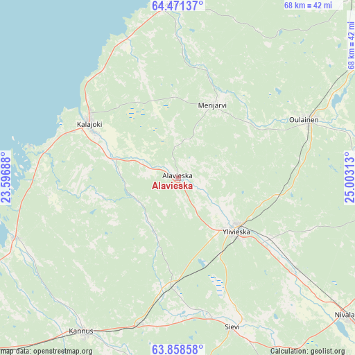
Alavieska GPS coordinates[2]
64° 10' 0.012" North, 24° 18' 0" East
| Map corner | latitude | longitude |
|---|---|---|
| Upper-left | 64.47137°, | 23.59688° |
| Center: | 64.16667°, | 24.3° |
| Lower-right: | 63.85858°, | 25.00313° |
| Map W x H: | 68.1×68.1 km | = 42.3×42.3mi |
| max Lat: | 69.90864° ⇑13.5% North |
| Alavieska: | 64.16667° |
| min Lat: | ⇓86.5% South 59.83333° |
| min Long | Alavieska | max Long |
| 21.2° | 24.3° | 30.93276° |
| W 42.9%⇐ | ⇒57.1% E |
Elevation
Elevation of Alavieska is 49 m = 161 ft, and this is 28.1 m = 92 ft below average elevation for this country.
| Max E: |
299 m = 981 ft | 66.5% |
| Avg. | 77.1 m = 253 ft | |
| Alavieska | 49 m = 161 ft | |
Min E: |
1 m = 3 ft | 33.5% |
See also: Finland elevation on elevation.city.
Geographical zone
Alavieska is located in North temperate zone (between Tropic of Cancer and the Arctic Circle). Distance of this North polar circle is 266.5 km =165.6 mi to North.| Distance of | km | miles | from Alavieska |
|---|---|---|---|
| North Pole | 2872.4 | 1784.8 | to North |
| Arctic Circle | 266.5 | 165.6 | to North |
| Tropic Cancer | 4528.7 | 2814 | to South |
| Equator | 7134.7 | 4433.3 | to South |


Nearby cities:
15 places around Alavieska: (largest is in red/bold)
• Haapavesi
51.8 km =32.2 mi,  94°
94°
• Himanka
33.4 km =20.8 mi,  249°
249°
• Kalajoki
19.3 km =12 mi,  298°
298°
• Kannus
35.5 km =22.1 mi,  213°
213°
• Kälviä
53.5 km =33.2 mi,  230°
230°
• Lohtaja
41.7 km =25.9 mi, 247°
• Merijärvi
16.5 km =10.3 mi,  26°
26°
• Nivala
42.7 km =26.5 mi,  130°
130°
• Oulainen
26.6 km =16.5 mi,  65°
65°
• Pyhäjoki
33.5 km =20.8 mi,  354°
354°
• Raahe
58.1 km =36.1 mi,  8°
8°
• Sievi
31.2 km =19.4 mi,  161°
161°
• Toholampi
44.5 km =27.7 mi,  183°
183°
• Vihanti
48.6 km =30.2 mi,  43°
43°
• Ylivieska
15.3 km =9.5 mi, 127°
Sources, notices
• [Note1] Compared only with cities in Finland existing in our database
• [Src1] Map data: © OpenStreetMap contributors (CC-BY-SA)
• [Src2] Other city data from geonames.org with taken over terms of usage.
• [Src3] Geographical zone / Annual Mean Temperature by Robert A. Rohde @ Wikipedia
