Pulap Village geodata
Pulap Village (Chuuk) is a populated place; located in Micronesia in Pacific/Chuuk (GMT+10) time zone. With population of 905 people, there are 8 cities with bigger population in this country. Compared to other cities in Micronesia, 71.7% of cities are located further ↓South; 73.3% of cities are located further →East and 51.7% of cities have higher elevation than Pulap Village. Note1


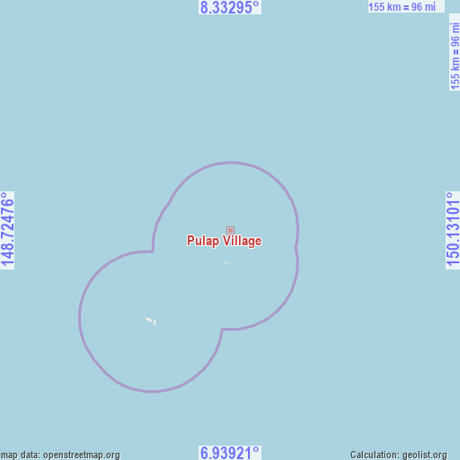
Pulap Village GPS coordinates[2]
7° 38' 11.94" North, 149° 25' 40.368" East
| Map corner | latitude | longitude |
|---|---|---|
| Upper-left | 8.33295°, | 148.72476° |
| Center: | 7.63665°, | 149.42788° |
| Lower-right: | 6.93921°, | 150.13101° |
| Map W x H: | 155×155 km | = 96.3×96.3mi |
| max Lat: | 9.766° ⇑28.3% North |
| Pulap Village: | 7.63665° |
| min Lat: | ⇓71.7% South 1.07861° |
| min Long | Pulap Village | max Long |
| 137.484° | 149.42788° | 163.02609° |
| W 26.7%⇐ | ⇒73.3% E |
Elevation
Elevation of Pulap Village is 11 m = 36 ft, and this is 3.8 m = 12 ft below average elevation for this country.
| Max E: |
92 m = 302 ft | 51.7% |
| Avg. | 14.8 m = 49 ft | |
| Pulap Village | 11 m = 36 ft | |
Min E: |
1 m = 3 ft | 48.3% |
See also: Micronesia elevation on elevation.city.
Geographical zone
Pulap Village is located in North Torrid zone (between Equator and Tropic of Cancer). Distance of Equator is 849.1 km =527.6 mi to South.| Distance of | km | miles | from Pulap Village |
|---|---|---|---|
| North Pole | 9157.9 | 5690.5 | to North |
| Arctic Circle | 6552.1 | 4071.3 | to North |
| Tropic Cancer | 1756.8 | 1091.6 | to North |
| Equator | 849.1 | 527.6 | to South |


Nearby cities:
15 places around Pulap Village: (largest is in red/bold)
• Houk
106.3 km =66.1 mi,  187°
187°
• Makur
168.5 km =104.7 mi,  27°
27°
• Nomwin
270.2 km =167.9 mi,  70°
70°
• Nomwin Village
270.2 km =167.9 mi, 70°
• Onou
160.4 km =99.7 mi,  36°
36°
• Onoun
108.2 km =67.2 mi,  15°
15°
• Onoun
108.5 km =67.4 mi, 15°
• Pisaras
150.5 km =93.5 mi,  46°
46°
• Polowat
40.1 km =24.9 mi,  219°
219°
• Pulap
0.1 km =0.1 mi,  93°
93°
• Satawal
265.6 km =165 mi,  263°
263°
• Satawal Village
266.3 km =165.5 mi, 263°
• Tamatam
11 km =6.8 mi, 187°
• Unanu
159.4 km =99 mi, 39°
• Weno
266.9 km =165.8 mi, 94°
Sources, notices
• [Note1] Compared only with cities in Micronesia existing in our database
• [Src1] Map data: © OpenStreetMap contributors (CC-BY-SA)
• [Src2] Other city data from geonames.org with taken over terms of usage.
• [Src3] Geographical zone / Annual Mean Temperature by Robert A. Rohde @ Wikipedia
