Warhem geodata
Warhem (Hauts-de-France) is a populated place; located in France in Europe/Paris (GMT+2) time zone. With population of 1,903 people, there are 5028 cities with bigger population in this country. Compared to other cities in France, 99.9% of cities are located further ↓South; 50.5% of cities are located further ←West and 98.6% of cities have higher elevation than Warhem. Note1
Administrative division(s):
- Level 1: Hauts-de-France
- Level 2: Nord
- Level 3: Arrondissement de Dunkerque
- Level 4: Warhem


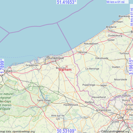
Warhem GPS coordinates[2]
50° 58' 33.312" North, 2° 29' 34.908" East
| Map corner | latitude | longitude |
|---|---|---|
| Upper-left | 51.41653°, | 1.7899° |
| Center: | 50.97592°, | 2.49303° |
| Lower-right: | 50.53109°, | 3.19615° |
| Map W x H: | 98.5×98.5 km | = 61.2×61.2mi |
| max Lat: | 51.07786° ⇑0.1% North |
| Warhem: | 50.97592° |
| min Lat: | ⇓99.9% South 41.3874° |
| min Long | Warhem | max Long |
| -5.08615° | 2.49303° | 9.52242° |
| W 50.5%⇐ | ⇒49.5% E |
Elevation
Elevation of Warhem is 7 m = 23 ft, and this is 186.7 m = 613 ft below average elevation for this country.
| Max E: |
2333 m = 7654 ft | 98.6% |
| Avg. | 193.7 m = 635 ft | |
| Warhem | 7 m = 23 ft | |
Min E: |
-1 m = -3 ft | 1.4% |
See also: France elevation on elevation.city.
Geographical zone
Warhem is located in North temperate zone (between Tropic of Cancer and the Arctic Circle). Distance of this North polar circle is 1733.2 km =1077 mi to North.| Distance of | km | miles | from Warhem |
|---|---|---|---|
| North Pole | 4339.1 | 2696.2 | to North |
| Arctic Circle | 1733.2 | 1077 | to North |
| Tropic Cancer | 3062.1 | 1902.7 | to South |
| Equator | 5668 | 3521.9 | to South |


Nearby cities:
15 places around Warhem: (largest is in red/bold)
• Bergues
4.3 km =2.7 mi,  259°
259°
• Bierne
6 km =3.7 mi, 255°
• Coudekerque-Village
6 km =3.7 mi,  296°
296°
• Crochte
8.7 km =5.4 mi,  238°
238°
• Hondschoote
6.4 km =4 mi,  87°
87°
• Hoymille
3.2 km =2 mi, 261°
• Killem
5.1 km =3.2 mi,  113°
113°
• Leffrinckoucke
6.8 km =4.2 mi,  342°
342°
• Les Moëres
5.8 km =3.6 mi,  42°
42°
• Quaëdypre
5.3 km =3.3 mi,  210°
210°
• Rexpoëde
5.2 km =3.2 mi,  141°
141°
• Socx
6.6 km =4.1 mi,  227°
227°
• Téteghem
5.8 km =3.6 mi,  324°
324°
• Uxem
5.1 km =3.2 mi,  352°
352°
• West-Cappel
5.2 km =3.2 mi,  170°
170°
Sources, notices
• [Note1] Compared only with cities in France existing in our database
• [Src1] Map data: © OpenStreetMap contributors (CC-BY-SA)
• [Src2] Other city data from geonames.org with taken over terms of usage.
• [Src3] Geographical zone / Annual Mean Temperature by Robert A. Rohde @ Wikipedia
