Hoymille geodata
Hoymille (Hauts-de-France) is a populated place; located in France in Europe/Paris (GMT+2) time zone. With population of 3,275 people, there are 2975 cities with bigger population in this country. Compared to other cities in France, 99.9% of cities are located further ↓South; 50.2% of cities are located further →East and 99.6% of cities have higher elevation than Hoymille. Note1
Administrative division(s):
- Level 1: Hauts-de-France
- Level 2: Nord
- Level 3: Arrondissement de Dunkerque
- Level 4: Hoymille


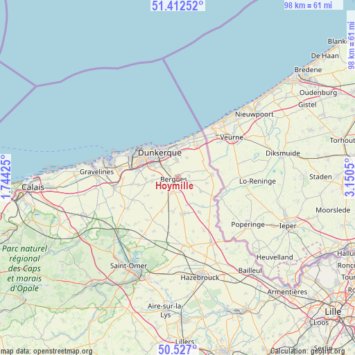
Hoymille GPS coordinates[2]
50° 58' 18.732" North, 2° 26' 50.568" East
| Map corner | latitude | longitude |
|---|---|---|
| Upper-left | 51.41252°, | 1.74425° |
| Center: | 50.97187°, | 2.44738° |
| Lower-right: | 50.527°, | 3.1505° |
| Map W x H: | 98.5×98.5 km | = 61.2×61.2mi |
| max Lat: | 51.07786° ⇑0.1% North |
| Hoymille: | 50.97187° |
| min Lat: | ⇓99.9% South 41.3874° |
| min Long | Hoymille | max Long |
| -5.08615° | 2.44738° | 9.52242° |
| W 49.8%⇐ | ⇒50.2% E |
Elevation
Elevation of Hoymille is 4 m = 13 ft, and this is 189.7 m = 622 ft below average elevation for this country.
| Max E: |
2333 m = 7654 ft | 99.6% |
| Avg. | 193.7 m = 635 ft | |
| Hoymille | 4 m = 13 ft | |
Min E: |
-1 m = -3 ft | 0.4% |
See also: France elevation on elevation.city.
Geographical zone
Hoymille is located in North temperate zone (between Tropic of Cancer and the Arctic Circle). Distance of this North polar circle is 1733.6 km =1077.2 mi to North.| Distance of | km | miles | from Hoymille |
|---|---|---|---|
| North Pole | 4339.5 | 2696.4 | to North |
| Arctic Circle | 1733.6 | 1077.2 | to North |
| Tropic Cancer | 3061.6 | 1902.4 | to South |
| Equator | 5667.5 | 3521.6 | to South |


Nearby cities:
15 places around Hoymille: (largest is in red/bold)
• Armbouts-Cappel
6.6 km =4.1 mi,  274°
274°
• Bergues
1.1 km =0.7 mi,  252°
252°
• Bierne
2.8 km =1.7 mi, 248°
• Cappelle-la-Grande
7 km =4.3 mi,  296°
296°
• Coudekerque-Branche
6.8 km =4.2 mi,  326°
326°
• Coudekerque-Village
3.8 km =2.4 mi, 325°
• Crochte
5.9 km =3.7 mi,  226°
226°
• Leffrinckoucke
7.1 km =4.4 mi,  9°
9°
• Quaëdypre
4.1 km =2.5 mi,  173°
173°
• Socx
4.3 km =2.7 mi,  201°
201°
• Steene
6 km =3.7 mi, 248°
• Téteghem
5.2 km =3.2 mi,  357°
357°
• Uxem
6.1 km =3.8 mi,  24°
24°
• Warhem
3.2 km =2 mi,  81°
81°
• West-Cappel
6.2 km =3.9 mi,  138°
138°
Sources, notices
• [Note1] Compared only with cities in France existing in our database
• [Src1] Map data: © OpenStreetMap contributors (CC-BY-SA)
• [Src2] Other city data from geonames.org with taken over terms of usage.
• [Src3] Geographical zone / Annual Mean Temperature by Robert A. Rohde @ Wikipedia
