Wargnies-le-Grand geodata
Wargnies-le-Grand (Hauts-de-France) is a populated place; located in France in Europe/Paris (GMT+2) time zone. With population of 1,076 people, there are 8284 cities with bigger population in this country. Compared to other cities in France, 95.6% of cities are located further ↓South; 65.5% of cities are located further ←West and 65.6% of cities have higher elevation than Wargnies-le-Grand. Note1
Administrative division(s):
- Level 1: Hauts-de-France
- Level 2: Nord
- Level 3: Avesnes-sur-Helpe
- Level 4: Wargnies-le-Grand


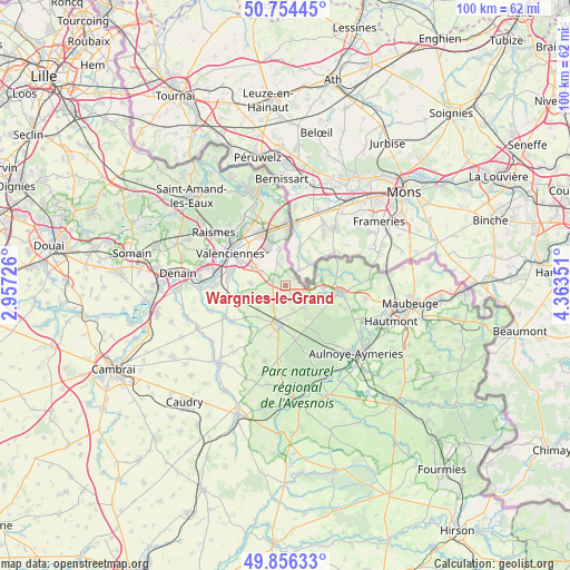
Wargnies-le-Grand GPS coordinates[2]
50° 18' 27.036" North, 3° 39' 37.368" East
| Map corner | latitude | longitude |
|---|---|---|
| Upper-left | 50.75445°, | 2.95726° |
| Center: | 50.30751°, | 3.66038° |
| Lower-right: | 49.85633°, | 4.36351° |
| Map W x H: | 99.9×99.9 km | = 62.1×62.1mi |
| max Lat: | 51.07786° ⇑4.4% North |
| Wargnies-le-Grand: | 50.30751° |
| min Lat: | ⇓95.6% South 41.3874° |
| min Long | Wargnies-le-Gra | max Long |
| -5.08615° | 3.66038° | 9.52242° |
| W 65.5%⇐ | ⇒34.5% E |
Elevation
Elevation of Wargnies-le-Grand is 88 m = 289 ft, and this is 105.7 m = 347 ft below average elevation for this country.
| Max E: |
2333 m = 7654 ft | 65.6% |
| Avg. | 193.7 m = 635 ft | |
| Wargnies-le-Grand | 88 m = 289 ft | |
Min E: |
-1 m = -3 ft | 34.4% |
See also: France elevation on elevation.city.
Geographical zone
Wargnies-le-Grand is located in North temperate zone (between Tropic of Cancer and the Arctic Circle). Distance of this North polar circle is 1807.5 km =1123.1 mi to North.| Distance of | km | miles | from Wargnies-le-Grand |
|---|---|---|---|
| North Pole | 4413.4 | 2742.4 | to North |
| Arctic Circle | 1807.5 | 1123.1 | to North |
| Tropic Cancer | 2987.8 | 1856.5 | to South |
| Equator | 5593.7 | 3475.8 | to South |


Nearby cities:
15 places around Wargnies-le-Grand: (largest is in red/bold)
• Curgies
4.8 km =3 mi,  301°
301°
• Estreux
6.8 km =4.2 mi,  316°
316°
• Gommegnies
5.2 km =3.2 mi,  140°
140°
• Jenlain
2.3 km =1.4 mi,  281°
281°
• Le Quesnoy
6.8 km =4.2 mi,  194°
194°
• Maresches
5.9 km =3.7 mi,  254°
254°
• Préseau
6.1 km =3.8 mi,  273°
273°
• Rombies-et-Marchipont
6.5 km =4 mi,  348°
348°
• Ruesnes
7.7 km =4.8 mi,  225°
225°
• Saultain
6.7 km =4.2 mi, 298°
• Sebourg
4.1 km =2.5 mi,  342°
342°
• Sepmeries
7.4 km =4.6 mi, 247°
• Villereau
5.7 km =3.5 mi,  176°
176°
• Villers-Pol
4.1 km =2.5 mi, 231°
• Wargnies-le-Petit
1.8 km =1.1 mi,  149°
149°
Sources, notices
• [Note1] Compared only with cities in France existing in our database
• [Src1] Map data: © OpenStreetMap contributors (CC-BY-SA)
• [Src2] Other city data from geonames.org with taken over terms of usage.
• [Src3] Geographical zone / Annual Mean Temperature by Robert A. Rohde @ Wikipedia
