Wannehain geodata
Wannehain (Hauts-de-France) is a populated place; located in France in Europe/Paris (GMT+2) time zone. With population of 854 people, there are 10043 cities with bigger population in this country. Compared to other cities in France, 97.8% of cities are located further ↓South; 61.6% of cities are located further ←West and 84.9% of cities have higher elevation than Wannehain. Note1
Administrative division(s):
- Level 1: Hauts-de-France
- Level 2: Nord
- Level 3: Arrondissement de Lille
- Level 4: Wannehain


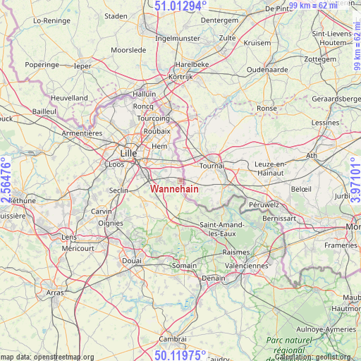
Wannehain GPS coordinates[2]
50° 34' 6.456" North, 3° 16' 4.368" East
| Map corner | latitude | longitude |
|---|---|---|
| Upper-left | 51.01294°, | 2.56476° |
| Center: | 50.56846°, | 3.26788° |
| Lower-right: | 50.11975°, | 3.97101° |
| Map W x H: | 99.3×99.3 km | = 61.7×61.7mi |
| max Lat: | 51.07786° ⇑2.2% North |
| Wannehain: | 50.56846° |
| min Lat: | ⇓97.8% South 41.3874° |
| min Long | Wannehain | max Long |
| -5.08615° | 3.26788° | 9.52242° |
| W 61.6%⇐ | ⇒38.4% E |
Elevation
Elevation of Wannehain is 42 m = 138 ft, and this is 151.7 m = 498 ft below average elevation for this country.
| Max E: |
2333 m = 7654 ft | 84.9% |
| Avg. | 193.7 m = 635 ft | |
| Wannehain | 42 m = 138 ft | |
Min E: |
-1 m = -3 ft | 15.1% |
See also: France elevation on elevation.city.
Geographical zone
Wannehain is located in North temperate zone (between Tropic of Cancer and the Arctic Circle). Distance of this North polar circle is 1778.5 km =1105.1 mi to North.| Distance of | km | miles | from Wannehain |
|---|---|---|---|
| North Pole | 4384.4 | 2724.3 | to North |
| Arctic Circle | 1778.5 | 1105.1 | to North |
| Tropic Cancer | 3016.8 | 1874.6 | to South |
| Equator | 5622.7 | 3493.8 | to South |


Nearby cities:
15 places around Wannehain: (largest is in red/bold)
• Anstaing
6.8 km =4.2 mi,  306°
306°
• Bachy
2 km =1.2 mi,  196°
196°
• Baisieux
4.6 km =2.9 mi,  346°
346°
• Bourghelles
1.7 km =1.1 mi,  256°
256°
• Bouvines
5.7 km =3.5 mi,  281°
281°
• Camphin-en-Pévèle
3.1 km =1.9 mi, 350°
• Chéreng
6.4 km =4 mi,  317°
317°
• Cobrieux
4 km =2.5 mi,  223°
223°
• Cysoing
3.6 km =2.2 mi,  271°
271°
• Genech
5.5 km =3.4 mi, 221°
• Gruson
5.2 km =3.2 mi, 305°
• Louvil
5.4 km =3.4 mi, 257°
• Mouchin
6.1 km =3.8 mi,  160°
160°
• Péronne-en-Mélantois
7 km =4.3 mi, 269°
• Willems
7.4 km =4.6 mi,  343°
343°
Sources, notices
• [Note1] Compared only with cities in France existing in our database
• [Src1] Map data: © OpenStreetMap contributors (CC-BY-SA)
• [Src2] Other city data from geonames.org with taken over terms of usage.
• [Src3] Geographical zone / Annual Mean Temperature by Robert A. Rohde @ Wikipedia
