Mouchin geodata
Mouchin (Hauts-de-France) is a populated place; located in France in Europe/Paris (GMT+2) time zone. With population of 1,371 people, there are 6723 cities with bigger population in this country. Compared to other cities in France, 97.5% of cities are located further ↓South; 62% of cities are located further ←West and 86.7% of cities have higher elevation than Mouchin. Note1
Administrative division(s):
- Level 1: Hauts-de-France
- Level 2: Nord
- Level 3: Arrondissement de Lille
- Level 4: Mouchin


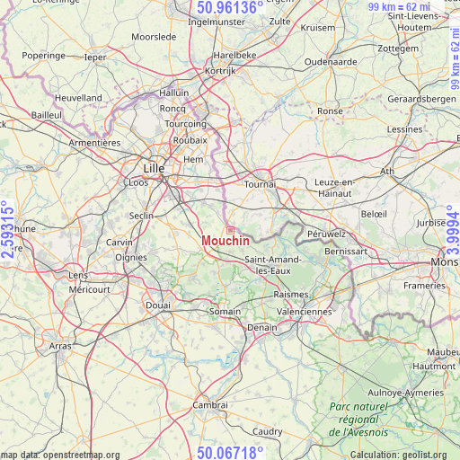
Mouchin GPS coordinates[2]
50° 30' 59.004" North, 3° 17' 46.572" East
| Map corner | latitude | longitude |
|---|---|---|
| Upper-left | 50.96136°, | 2.59315° |
| Center: | 50.51639°, | 3.29627° |
| Lower-right: | 50.06718°, | 3.9994° |
| Map W x H: | 99.4×99.4 km | = 61.8×61.8mi |
| max Lat: | 51.07786° ⇑2.5% North |
| Mouchin: | 50.51639° |
| min Lat: | ⇓97.5% South 41.3874° |
| min Long | Mouchin | max Long |
| -5.08615° | 3.29627° | 9.52242° |
| W 62%⇐ | ⇒38% E |
Elevation
Elevation of Mouchin is 38 m = 125 ft, and this is 155.7 m = 511 ft below average elevation for this country.
| Max E: |
2333 m = 7654 ft | 86.7% |
| Avg. | 193.7 m = 635 ft | |
| Mouchin | 38 m = 125 ft | |
Min E: |
-1 m = -3 ft | 13.3% |
See also: France elevation on elevation.city.
Geographical zone
Mouchin is located in North temperate zone (between Tropic of Cancer and the Arctic Circle). Distance of this North polar circle is 1784.3 km =1108.7 mi to North.| Distance of | km | miles | from Mouchin |
|---|---|---|---|
| North Pole | 4390.2 | 2727.9 | to North |
| Arctic Circle | 1784.3 | 1108.7 | to North |
| Tropic Cancer | 3011 | 1870.9 | to South |
| Equator | 5616.9 | 3490.2 | to South |


Nearby cities:
15 places around Mouchin: (largest is in red/bold)
• Aix-en-Pévèle
3 km =1.9 mi,  181°
181°
• Bachy
4.6 km =2.9 mi,  325°
325°
• Bourghelles
6.5 km =4 mi, 325°
• Cobrieux
5.6 km =3.5 mi,  301°
301°
• Cysoing
8.2 km =5.1 mi,  316°
316°
• Genech
5.9 km =3.7 mi,  286°
286°
• Landas
4.9 km =3 mi,  173°
173°
• Louvil
8.6 km =5.3 mi, 302°
• Nomain
3.8 km =2.4 mi,  238°
238°
• Orchies
7.1 km =4.4 mi,  218°
218°
• Rosult
7.8 km =4.8 mi,  145°
145°
• Rumegies
5 km =3.1 mi,  128°
128°
• Saméon
5.7 km =3.5 mi, 151°
• Templeuve-en-Pévèle
8.4 km =5.2 mi,  275°
275°
• Wannehain
6.1 km =3.8 mi,  340°
340°
Sources, notices
• [Note1] Compared only with cities in France existing in our database
• [Src1] Map data: © OpenStreetMap contributors (CC-BY-SA)
• [Src2] Other city data from geonames.org with taken over terms of usage.
• [Src3] Geographical zone / Annual Mean Temperature by Robert A. Rohde @ Wikipedia
