Louvil geodata
Louvil (Hauts-de-France) is a populated place; located in France in Europe/Paris (GMT+2) time zone. With population of 855 people, there are 10032 cities with bigger population in this country. Compared to other cities in France, 97.8% of cities are located further ↓South; 60.5% of cities are located further ←West and 88.6% of cities have higher elevation than Louvil. Note1
Administrative division(s):
- Level 1: Hauts-de-France
- Level 2: Nord
- Level 3: Arrondissement de Lille
- Level 4: Louvil


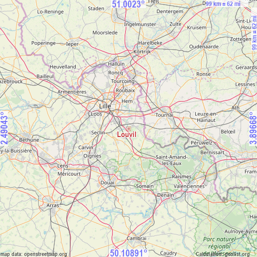
Louvil GPS coordinates[2]
50° 33' 27.792" North, 3° 11' 36.816" East
| Map corner | latitude | longitude |
|---|---|---|
| Upper-left | 51.0023°, | 2.49043° |
| Center: | 50.55772°, | 3.19356° |
| Lower-right: | 50.10891°, | 3.89668° |
| Map W x H: | 99.3×99.3 km | = 61.7×61.7mi |
| max Lat: | 51.07786° ⇑2.2% North |
| Louvil: | 50.55772° |
| min Lat: | ⇓97.8% South 41.3874° |
| min Long | Louvil | max Long |
| -5.08615° | 3.19356° | 9.52242° |
| W 60.5%⇐ | ⇒39.5% E |
Elevation
Elevation of Louvil is 33 m = 108 ft, and this is 160.7 m = 527 ft below average elevation for this country.
| Max E: |
2333 m = 7654 ft | 88.6% |
| Avg. | 193.7 m = 635 ft | |
| Louvil | 33 m = 108 ft | |
Min E: |
-1 m = -3 ft | 11.4% |
See also: France elevation on elevation.city.
Geographical zone
Louvil is located in North temperate zone (between Tropic of Cancer and the Arctic Circle). Distance of this North polar circle is 1779.7 km =1105.9 mi to North.| Distance of | km | miles | from Louvil |
|---|---|---|---|
| North Pole | 4385.6 | 2725.1 | to North |
| Arctic Circle | 1779.7 | 1105.9 | to North |
| Tropic Cancer | 3015.6 | 1873.8 | to South |
| Equator | 5621.5 | 3493 | to South |


Nearby cities:
15 places around Louvil: (largest is in red/bold)
• Anstaing
5.2 km =3.2 mi,  357°
357°
• Bachy
4.7 km =2.9 mi,  99°
99°
• Bourghelles
3.7 km =2.3 mi,  77°
77°
• Bouvines
2.3 km =1.4 mi,  351°
351°
• Cappelle-en-Pévèle
5.5 km =3.4 mi,  196°
196°
• Cobrieux
3 km =1.9 mi,  124°
124°
• Cysoing
2.1 km =1.3 mi,  51°
51°
• Ennevelin
4.9 km =3 mi,  247°
247°
• Fretin
4 km =2.5 mi,  269°
269°
• Genech
3.4 km =2.1 mi,  151°
151°
• Gruson
4.4 km =2.7 mi,  13°
13°
• Péronne-en-Mélantois
2.1 km =1.3 mi,  303°
303°
• Sainghin-en-Mélantois
3.9 km =2.4 mi,  330°
330°
• Templeuve-en-Pévèle
4 km =2.5 mi, 195°
• Wannehain
5.4 km =3.4 mi, 77°
Sources, notices
• [Note1] Compared only with cities in France existing in our database
• [Src1] Map data: © OpenStreetMap contributors (CC-BY-SA)
• [Src2] Other city data from geonames.org with taken over terms of usage.
• [Src3] Geographical zone / Annual Mean Temperature by Robert A. Rohde @ Wikipedia
