Vitry-en-Perthois geodata
Vitry-en-Perthois (Grand Est) is a populated place; located in France in Europe/Paris (GMT+2) time zone. With population of 827 people, there are 10320 cities with bigger population in this country. Compared to other cities in France, 74.2% of cities are located further ↓South; 73.1% of cities are located further ←West and 60.8% of cities have higher elevation than Vitry-en-Perthois. Note1
Administrative division(s):
- Level 1: Grand Est
- Level 2: Marne
- Level 3: Arrondissement de Vitry-le-François
- Level 4: Vitry-en-Perthois


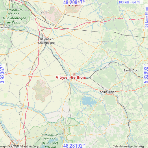
Vitry-en-Perthois GPS coordinates[2]
48° 44' 51.648" North, 4° 37' 36.444" East
| Map corner | latitude | longitude |
|---|---|---|
| Upper-left | 49.20917°, | 3.92367° |
| Center: | 48.74768°, | 4.62679° |
| Lower-right: | 48.28192°, | 5.32992° |
| Map W x H: | 103.1×103.1 km | = 64.1×64.1mi |
| max Lat: | 51.07786° ⇑25.8% North |
| Vitry-en-Perthois: | 48.74768° |
| min Lat: | ⇓74.2% South 41.3874° |
| min Long | Vitry-en-Pertho | max Long |
| -5.08615° | 4.62679° | 9.52242° |
| W 73.1%⇐ | ⇒26.9% E |
Elevation
Elevation of Vitry-en-Perthois is 100 m = 328 ft, and this is 93.7 m = 307 ft below average elevation for this country.
| Max E: |
2333 m = 7654 ft | 60.8% |
| Avg. | 193.7 m = 635 ft | |
| Vitry-en-Perthois | 100 m = 328 ft | |
Min E: |
-1 m = -3 ft | 39.2% |
See also: France elevation on elevation.city.
Geographical zone
Vitry-en-Perthois is located in North temperate zone (between Tropic of Cancer and the Arctic Circle). Distance of this North polar circle is 1980.9 km =1230.9 mi to North.| Distance of | km | miles | from Vitry-en-Perthois |
|---|---|---|---|
| North Pole | 4586.8 | 2850.1 | to North |
| Arctic Circle | 1980.9 | 1230.9 | to North |
| Tropic Cancer | 2814.3 | 1748.7 | to South |
| Equator | 5420.2 | 3368 | to South |


Nearby cities:
15 places around Vitry-en-Perthois: (largest is in red/bold)
• Blacy
5.9 km =3.7 mi,  244°
244°
• Couvrot
4.3 km =2.7 mi,  285°
285°
• Frignicourt
5.9 km =3.7 mi,  205°
205°
• La Chaussée-sur-Marne
12.3 km =7.6 mi,  321°
321°
• Loisy-sur-Marne
6.1 km =3.8 mi,  280°
280°
• Marolles
3.5 km =2.2 mi,  181°
181°
• Maurupt-le-Montois
16.4 km =10.2 mi,  88°
88°
• Pargny-sur-Saulx
15.6 km =9.7 mi,  81°
81°
• Perthes
17.7 km =11 mi,  125°
125°
• Pogny
16.2 km =10.1 mi, 319°
• Saint-Amand-sur-Fion
7.3 km =4.5 mi,  347°
347°
• Saint-Germain-la-Ville
19.9 km =12.4 mi, 318°
• Saint-Remy-en-Bouzemont-Saint-Genest-et-Isson
12.8 km =8 mi,  172°
172°
• Thiéblemont-Farémont
9.9 km =6.2 mi, 130°
• Vitry-le-François
4 km =2.5 mi,  230°
230°
Sources, notices
• [Note1] Compared only with cities in France existing in our database
• [Src1] Map data: © OpenStreetMap contributors (CC-BY-SA)
• [Src2] Other city data from geonames.org with taken over terms of usage.
• [Src3] Geographical zone / Annual Mean Temperature by Robert A. Rohde @ Wikipedia
