Pogny geodata
Pogny (Grand Est) is a populated place; located in France in Europe/Paris (GMT+2) time zone. With population of 665 people, there are 12292 cities with bigger population in this country. Compared to other cities in France, 76.8% of cities are located further ↓South; 72% of cities are located further ←West and 59.7% of cities have higher elevation than Pogny. Note1
Administrative division(s):
- Level 1: Grand Est
- Level 2: Marne
- Level 3: Arrondissement de Châlons-en-Champagne
- Level 4: Pogny


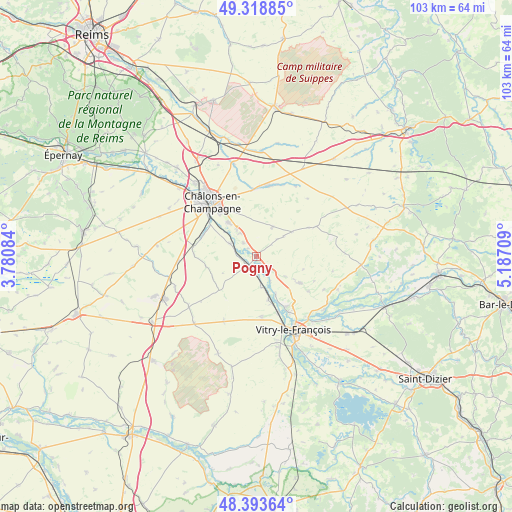
Pogny GPS coordinates[2]
48° 51' 30.168" North, 4° 29' 2.256" East
| Map corner | latitude | longitude |
|---|---|---|
| Upper-left | 49.31885°, | 3.78084° |
| Center: | 48.85838°, | 4.48396° |
| Lower-right: | 48.39364°, | 5.18709° |
| Map W x H: | 102.9×102.9 km | = 63.9×63.9mi |
| max Lat: | 51.07786° ⇑23.2% North |
| Pogny: | 48.85838° |
| min Lat: | ⇓76.8% South 41.3874° |
| min Long | Pogny | max Long |
| -5.08615° | 4.48396° | 9.52242° |
| W 72%⇐ | ⇒28% E |
Elevation
Elevation of Pogny is 103 m = 338 ft, and this is 90.7 m = 298 ft below average elevation for this country.
| Max E: |
2333 m = 7654 ft | 59.7% |
| Avg. | 193.7 m = 635 ft | |
| Pogny | 103 m = 338 ft | |
Min E: |
-1 m = -3 ft | 40.3% |
See also: France elevation on elevation.city.
Geographical zone
Pogny is located in North temperate zone (between Tropic of Cancer and the Arctic Circle). Distance of this North polar circle is 1968.6 km =1223.2 mi to North.| Distance of | km | miles | from Pogny |
|---|---|---|---|
| North Pole | 4574.5 | 2842.5 | to North |
| Arctic Circle | 1968.6 | 1223.2 | to North |
| Tropic Cancer | 2826.6 | 1756.4 | to South |
| Equator | 5432.5 | 3375.6 | to South |


Nearby cities:
15 places around Pogny: (largest is in red/bold)
• Blacy
15.7 km =9.8 mi,  160°
160°
• Châlons-en-Champagne
13.6 km =8.5 mi,  321°
321°
• Compertrix
13.7 km =8.5 mi,  312°
312°
• Courtisols
14.5 km =9 mi,  9°
9°
• Couvrot
12.9 km =8 mi,  150°
150°
• La Chaussée-sur-Marne
3.9 km =2.4 mi,  133°
133°
• Loisy-sur-Marne
12 km =7.5 mi, 158°
• L’Épine
13.4 km =8.3 mi,  356°
356°
• Mairy-sur-Marne
5.9 km =3.7 mi,  295°
295°
• Moncetz-Longevas
7.1 km =4.4 mi, 323°
• Saint-Amand-sur-Fion
10.3 km =6.4 mi,  120°
120°
• Saint-Germain-la-Ville
3.8 km =2.4 mi, 314°
• Saint-Memmie
12.8 km =8 mi,  325°
325°
• Sarry
8.8 km =5.5 mi, 319°
• Vitry-en-Perthois
16.2 km =10.1 mi,  139°
139°
Sources, notices
• [Note1] Compared only with cities in France existing in our database
• [Src1] Map data: © OpenStreetMap contributors (CC-BY-SA)
• [Src2] Other city data from geonames.org with taken over terms of usage.
• [Src3] Geographical zone / Annual Mean Temperature by Robert A. Rohde @ Wikipedia
