Vitry-en-Artois geodata
Vitry-en-Artois (Hauts-de-France) is a populated place; located in France in Europe/Paris (GMT+2) time zone. With population of 4,692 people, there are 2105 cities with bigger population in this country. Compared to other cities in France, 95.8% of cities are located further ↓South; 57.5% of cities are located further ←West and 82.2% of cities have higher elevation than Vitry-en-Artois. Note1
Administrative division(s):
- Level 1: Hauts-de-France
- Level 2: Pas-de-Calais
- Level 3: Arras
- Level 4: Vitry-en-Artois


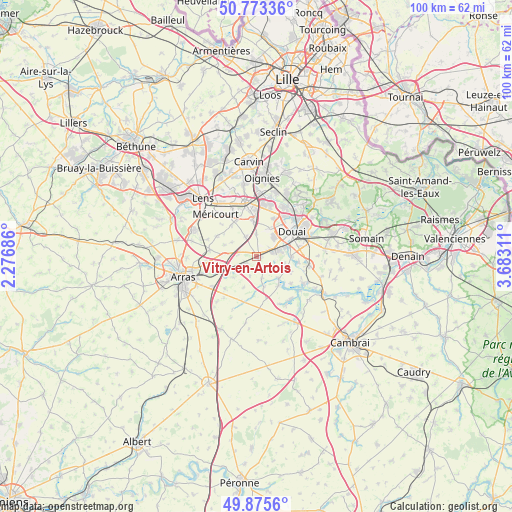
Vitry-en-Artois GPS coordinates[2]
50° 19' 35.76" North, 2° 58' 47.964" East
| Map corner | latitude | longitude |
|---|---|---|
| Upper-left | 50.77336°, | 2.27686° |
| Center: | 50.3266°, | 2.97999° |
| Lower-right: | 49.8756°, | 3.68311° |
| Map W x H: | 99.8×99.8 km | = 62×62mi |
| max Lat: | 51.07786° ⇑4.2% North |
| Vitry-en-Artois: | 50.3266° |
| min Lat: | ⇓95.8% South 41.3874° |
| min Long | Vitry-en-Artois | max Long |
| -5.08615° | 2.97999° | 9.52242° |
| W 57.5%⇐ | ⇒42.5% E |
Elevation
Elevation of Vitry-en-Artois is 49 m = 161 ft, and this is 144.7 m = 475 ft below average elevation for this country.
| Max E: |
2333 m = 7654 ft | 82.2% |
| Avg. | 193.7 m = 635 ft | |
| Vitry-en-Artois | 49 m = 161 ft | |
Min E: |
-1 m = -3 ft | 17.8% |
See also: France elevation on elevation.city.
Geographical zone
Vitry-en-Artois is located in North temperate zone (between Tropic of Cancer and the Arctic Circle). Distance of this North polar circle is 1805.4 km =1121.8 mi to North.| Distance of | km | miles | from Vitry-en-Artois |
|---|---|---|---|
| North Pole | 4411.3 | 2741.1 | to North |
| Arctic Circle | 1805.4 | 1121.8 | to North |
| Tropic Cancer | 2989.9 | 1857.8 | to South |
| Equator | 5595.8 | 3477.1 | to South |


Nearby cities:
15 places around Vitry-en-Artois: (largest is in red/bold)
• Biache-Saint-Vaast
3 km =1.9 mi,  228°
228°
• Brebières
2.7 km =1.7 mi,  73°
73°
• Corbehem
5 km =3.1 mi,  83°
83°
• Courchelettes
5.8 km =3.6 mi, 74°
• Esquerchin
6 km =3.7 mi,  23°
23°
• Férin
6.7 km =4.2 mi,  89°
89°
• Gouy-sous-Bellonne
5.7 km =3.5 mi,  107°
107°
• Izel-lès-Équerchin
4.4 km =2.7 mi,  330°
330°
• Lambres-lez-Douai
6.7 km =4.2 mi, 67°
• Noyelles-sous-Bellonne
3.9 km =2.4 mi,  121°
121°
• Pelves
6.2 km =3.9 mi, 229°
• Quiéry-la-Motte
4.4 km =2.7 mi,  358°
358°
• Rœux
6.6 km =4.1 mi,  238°
238°
• Sailly-en-Ostrevent
4.3 km =2.7 mi,  167°
167°
• Tortequesne
6 km =3.7 mi,  134°
134°
Sources, notices
• [Note1] Compared only with cities in France existing in our database
• [Src1] Map data: © OpenStreetMap contributors (CC-BY-SA)
• [Src2] Other city data from geonames.org with taken over terms of usage.
• [Src3] Geographical zone / Annual Mean Temperature by Robert A. Rohde @ Wikipedia
