Villette geodata
Villette (Île-de-France) is a populated place; located in France in Europe/Paris (GMT+2) time zone. With population of 510 people, there are 15036 cities with bigger population in this country. Compared to other cities in France, 78.1% of cities are located further ↓South; 60.5% of cities are located further →East and 81.8% of cities have higher elevation than Villette. Note1
Administrative division(s):
- Level 1: Île-de-France
- Level 2: Yvelines
- Level 3: Arrondissement de Mantes-la-Jolie
- Level 4: Villette


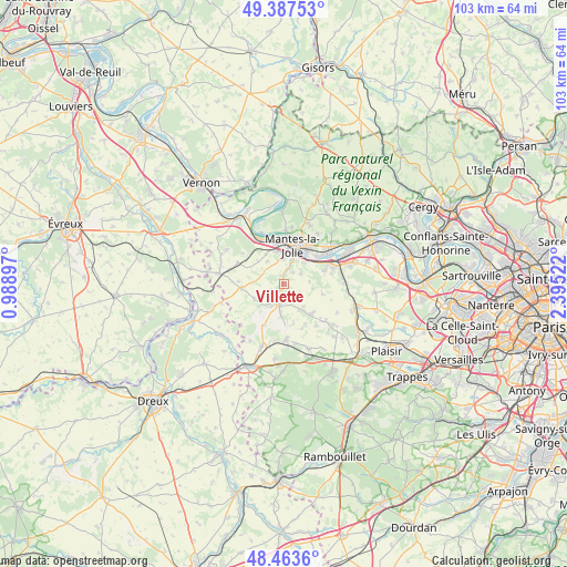
Villette GPS coordinates[2]
48° 55' 39.72" North, 1° 41' 31.524" East
| Map corner | latitude | longitude |
|---|---|---|
| Upper-left | 49.38753°, | 0.98897° |
| Center: | 48.9277°, | 1.69209° |
| Lower-right: | 48.4636°, | 2.39522° |
| Map W x H: | 102.7×102.7 km | = 63.8×63.8mi |
| max Lat: | 51.07786° ⇑21.9% North |
| Villette: | 48.9277° |
| min Lat: | ⇓78.1% South 41.3874° |
| min Long | Villette | max Long |
| -5.08615° | 1.69209° | 9.52242° |
| W 39.5%⇐ | ⇒60.5% E |
Elevation
Elevation of Villette is 50 m = 164 ft, and this is 143.7 m = 471 ft below average elevation for this country.
| Max E: |
2333 m = 7654 ft | 81.8% |
| Avg. | 193.7 m = 635 ft | |
| Villette | 50 m = 164 ft | |
Min E: |
-1 m = -3 ft | 18.2% |
See also: France elevation on elevation.city.
Geographical zone
Villette is located in North temperate zone (between Tropic of Cancer and the Arctic Circle). Distance of this North polar circle is 1960.9 km =1218.4 mi to North.| Distance of | km | miles | from Villette |
|---|---|---|---|
| North Pole | 4566.8 | 2837.7 | to North |
| Arctic Circle | 1960.9 | 1218.4 | to North |
| Tropic Cancer | 2834.3 | 1761.2 | to South |
| Equator | 5440.3 | 3380.4 | to South |


Nearby cities:
15 places around Villette: (largest is in red/bold)
• Arnouville-lès-Mantes
3.5 km =2.2 mi,  124°
124°
• Auffreville-Brasseuil
3.2 km =2 mi,  23°
23°
• Breuil-Bois-Robert
2.7 km =1.7 mi,  42°
42°
• Buchelay
6 km =3.7 mi,  344°
344°
• Dammartin-en-Serve
6 km =3.7 mi,  242°
242°
• Goussonville
5.3 km =3.3 mi,  99°
99°
• Guerville
3.6 km =2.2 mi,  59°
59°
• Jouy-Mauvoisin
6.2 km =3.9 mi,  329°
329°
• Jumeauville
7.2 km =4.5 mi, 104°
• Magnanville
4.6 km =2.9 mi,  347°
347°
• Mantes-la-Jolie
7.2 km =4.5 mi,  14°
14°
• Mantes-la-Ville
5.2 km =3.2 mi, 8°
• Septeuil
4 km =2.5 mi,  189°
189°
• Soindres
3.6 km =2.2 mi, 340°
• Vert
1.7 km =1.1 mi,  0°
0°
Sources, notices
• [Note1] Compared only with cities in France existing in our database
• [Src1] Map data: © OpenStreetMap contributors (CC-BY-SA)
• [Src2] Other city data from geonames.org with taken over terms of usage.
• [Src3] Geographical zone / Annual Mean Temperature by Robert A. Rohde @ Wikipedia
