Guerville geodata
Guerville (Île-de-France) is a populated place; located in France in Europe/Paris (GMT+2) time zone. With population of 1,990 people, there are 4812 cities with bigger population in this country. Compared to other cities in France, 78.4% of cities are located further ↓South; 60.1% of cities are located further →East and 64% of cities have higher elevation than Guerville. Note1
Administrative division(s):
- Level 1: Île-de-France
- Level 2: Yvelines
- Level 3: Arrondissement de Mantes-la-Jolie
- Level 4: Guerville


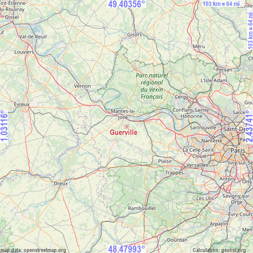
Guerville GPS coordinates[2]
48° 56' 37.968" North, 1° 44' 3.444" East
| Map corner | latitude | longitude |
|---|---|---|
| Upper-left | 49.40356°, | 1.03116° |
| Center: | 48.94388°, | 1.73429° |
| Lower-right: | 48.47993°, | 2.43741° |
| Map W x H: | 102.7×102.7 km | = 63.8×63.8mi |
| max Lat: | 51.07786° ⇑21.6% North |
| Guerville: | 48.94388° |
| min Lat: | ⇓78.4% South 41.3874° |
| min Long | Guerville | max Long |
| -5.08615° | 1.73429° | 9.52242° |
| W 39.9%⇐ | ⇒60.1% E |
Elevation
Elevation of Guerville is 92 m = 302 ft, and this is 101.7 m = 334 ft below average elevation for this country.
| Max E: |
2333 m = 7654 ft | 64% |
| Avg. | 193.7 m = 635 ft | |
| Guerville | 92 m = 302 ft | |
Min E: |
-1 m = -3 ft | 36% |
See also: France elevation on elevation.city.
Geographical zone
Guerville is located in North temperate zone (between Tropic of Cancer and the Arctic Circle). Distance of this North polar circle is 1959.1 km =1217.3 mi to North.| Distance of | km | miles | from Guerville |
|---|---|---|---|
| North Pole | 4565 | 2836.6 | to North |
| Arctic Circle | 1959.1 | 1217.3 | to North |
| Tropic Cancer | 2836.1 | 1762.3 | to South |
| Equator | 5442 | 3381.5 | to South |


Nearby cities:
15 places around Guerville: (largest is in red/bold)
• Arnouville-lès-Mantes
3.8 km =2.4 mi,  183°
183°
• Auffreville-Brasseuil
2.1 km =1.3 mi,  302°
302°
• Breuil-Bois-Robert
1.3 km =0.8 mi,  278°
278°
• Buchelay
6.1 km =3.8 mi,  310°
310°
• Goussonville
3.4 km =2.1 mi,  140°
140°
• Jumeauville
5.3 km =3.3 mi,  133°
133°
• Limay
5.8 km =3.6 mi,  4°
4°
• Magnanville
4.9 km =3 mi, 303°
• Mantes-la-Jolie
5.3 km =3.3 mi,  346°
346°
• Mantes-la-Ville
4 km =2.5 mi,  325°
325°
• Mézières-sur-Seine
4.7 km =2.9 mi,  65°
65°
• Porcheville
4.6 km =2.9 mi,  46°
46°
• Soindres
4.6 km =2.9 mi,  289°
289°
• Vert
3.1 km =1.9 mi,  268°
268°
• Villette
3.6 km =2.2 mi,  239°
239°
Sources, notices
• [Note1] Compared only with cities in France existing in our database
• [Src1] Map data: © OpenStreetMap contributors (CC-BY-SA)
• [Src2] Other city data from geonames.org with taken over terms of usage.
• [Src3] Geographical zone / Annual Mean Temperature by Robert A. Rohde @ Wikipedia
