Villenoy geodata
Villenoy (Île-de-France) is a populated place; located in France in Europe/Paris (GMT+2) time zone. With population of 3,887 people, there are 2528 cities with bigger population in this country. Compared to other cities in France, 78.4% of cities are located further ↓South; 55.8% of cities are located further ←West and 81.1% of cities have higher elevation than Villenoy. Note1
Administrative division(s):
- Level 1: Île-de-France
- Level 2: Seine-et-Marne
- Level 3: Arrondissement de Meaux
- Level 4: Villenoy


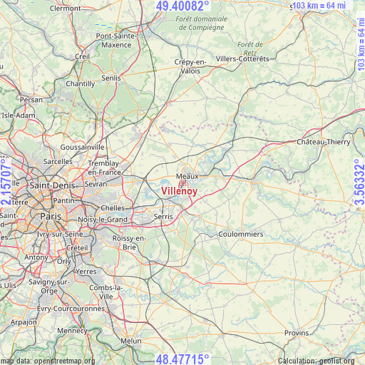
Villenoy GPS coordinates[2]
48° 56' 28.032" North, 2° 51' 36.72" East
| Map corner | latitude | longitude |
|---|---|---|
| Upper-left | 49.40082°, | 2.15707° |
| Center: | 48.94112°, | 2.8602° |
| Lower-right: | 48.47715°, | 3.56332° |
| Map W x H: | 102.7×102.7 km | = 63.8×63.8mi |
| max Lat: | 51.07786° ⇑21.6% North |
| Villenoy: | 48.94112° |
| min Lat: | ⇓78.4% South 41.3874° |
| min Long | Villenoy | max Long |
| -5.08615° | 2.8602° | 9.52242° |
| W 55.8%⇐ | ⇒44.2% E |
Elevation
Elevation of Villenoy is 52 m = 171 ft, and this is 141.7 m = 465 ft below average elevation for this country.
| Max E: |
2333 m = 7654 ft | 81.1% |
| Avg. | 193.7 m = 635 ft | |
| Villenoy | 52 m = 171 ft | |
Min E: |
-1 m = -3 ft | 18.9% |
See also: France elevation on elevation.city.
Geographical zone
Villenoy is located in North temperate zone (between Tropic of Cancer and the Arctic Circle). Distance of this North polar circle is 1959.4 km =1217.5 mi to North.| Distance of | km | miles | from Villenoy |
|---|---|---|---|
| North Pole | 4565.3 | 2836.7 | to North |
| Arctic Circle | 1959.4 | 1217.5 | to North |
| Tropic Cancer | 2835.8 | 1762.1 | to South |
| Equator | 5441.7 | 3381.3 | to South |


Nearby cities:
15 places around Villenoy: (largest is in red/bold)
• Boutigny
5.6 km =3.5 mi,  114°
114°
• Chauconin-Neufmontiers
2.9 km =1.8 mi,  345°
345°
• Condé-Sainte-Libiaire
5.1 km =3.2 mi,  197°
197°
• Couilly-Pont-aux-Dames
6.3 km =3.9 mi,  182°
182°
• Crégy-lès-Meaux
4.1 km =2.5 mi,  15°
15°
• Esbly
5.3 km =3.3 mi,  221°
221°
• Fublaines
5.6 km =3.5 mi,  93°
93°
• Isles-lès-Villenoy
4 km =2.5 mi, 217°
• Mareuil-lès-Meaux
1.6 km =1 mi, 177°
• Meaux
2.5 km =1.6 mi,  32°
32°
• Nanteuil-lès-Meaux
2.9 km =1.8 mi,  116°
116°
• Penchard
5 km =3.1 mi,  0°
0°
• Poincy
6.4 km =4 mi,  60°
60°
• Quincy-Voisins
4.6 km =2.9 mi,  165°
165°
• Trilbardou
3.9 km =2.4 mi,  272°
272°
Sources, notices
• [Note1] Compared only with cities in France existing in our database
• [Src1] Map data: © OpenStreetMap contributors (CC-BY-SA)
• [Src2] Other city data from geonames.org with taken over terms of usage.
• [Src3] Geographical zone / Annual Mean Temperature by Robert A. Rohde @ Wikipedia
