Crégy-lès-Meaux geodata
Crégy-lès-Meaux (Île-de-France) is a populated place; located in France in Europe/Paris (GMT+2) time zone. With population of 4,061 people, there are 2418 cities with bigger population in this country. Compared to other cities in France, 79.1% of cities are located further ↓South; 56.1% of cities are located further ←West and 66% of cities have higher elevation than Crégy-lès-Meaux. Note1
Administrative division(s):
- Level 1: Île-de-France
- Level 2: Seine-et-Marne
- Level 3: Arrondissement de Meaux
- Level 4: Crégy-lès-Meaux


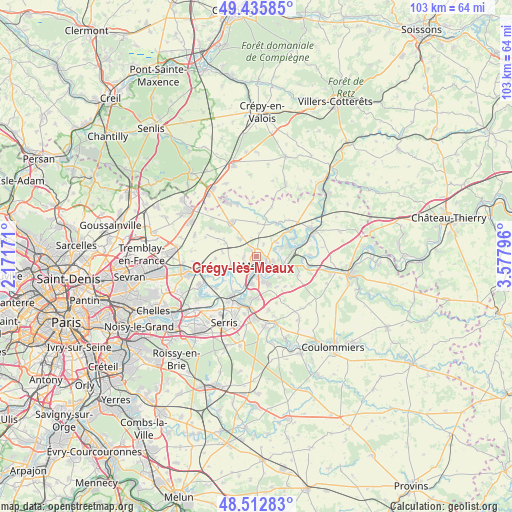
Crégy-lès-Meaux GPS coordinates[2]
48° 58' 35.328" North, 2° 52' 29.388" East
| Map corner | latitude | longitude |
|---|---|---|
| Upper-left | 49.43585°, | 2.17171° |
| Center: | 48.97648°, | 2.87483° |
| Lower-right: | 48.51283°, | 3.57796° |
| Map W x H: | 102.6×102.6 km | = 63.8×63.8mi |
| max Lat: | 51.07786° ⇑20.9% North |
| Crégy-lès-Meaux: | 48.97648° |
| min Lat: | ⇓79.1% South 41.3874° |
| min Long | Crégy-lès-Mea | max Long |
| -5.08615° | 2.87483° | 9.52242° |
| W 56.1%⇐ | ⇒43.9% E |
Elevation
Elevation of Crégy-lès-Meaux is 87 m = 285 ft, and this is 106.7 m = 350 ft below average elevation for this country.
| Max E: |
2333 m = 7654 ft | 66% |
| Avg. | 193.7 m = 635 ft | |
| Crégy-lès-Meaux | 87 m = 285 ft | |
Min E: |
-1 m = -3 ft | 34% |
See also: France elevation on elevation.city.
Geographical zone
Crégy-lès-Meaux is located in North temperate zone (between Tropic of Cancer and the Arctic Circle). Distance of this North polar circle is 1955.5 km =1215.1 mi to North.| Distance of | km | miles | from Crégy-lès-Meaux |
|---|---|---|---|
| North Pole | 4561.4 | 2834.3 | to North |
| Arctic Circle | 1955.5 | 1215.1 | to North |
| Tropic Cancer | 2839.8 | 1764.6 | to South |
| Equator | 5445.7 | 3383.8 | to South |


Nearby cities:
15 places around Crégy-lès-Meaux: (largest is in red/bold)
• Chambry
2.8 km =1.7 mi,  29°
29°
• Chauconin-Neufmontiers
2.1 km =1.3 mi,  238°
238°
• Fublaines
6.2 km =3.9 mi,  133°
133°
• Iverny
6.8 km =4.2 mi,  293°
293°
• Mareuil-lès-Meaux
5.6 km =3.5 mi,  190°
190°
• Meaux
1.8 km =1.1 mi,  170°
170°
• Monthyon
5 km =3.1 mi,  314°
314°
• Nanteuil-lès-Meaux
5.5 km =3.4 mi,  163°
163°
• Penchard
1.5 km =0.9 mi,  317°
317°
• Poincy
4.6 km =2.9 mi,  99°
99°
• Trilbardou
6.3 km =3.9 mi,  232°
232°
• Trilport
6 km =3.7 mi,  111°
111°
• Varreddes
4.9 km =3 mi,  52°
52°
• Villenoy
4.1 km =2.5 mi,  195°
195°
• Villeroy
6.8 km =4.2 mi,  276°
276°
Sources, notices
• [Note1] Compared only with cities in France existing in our database
• [Src1] Map data: © OpenStreetMap contributors (CC-BY-SA)
• [Src2] Other city data from geonames.org with taken over terms of usage.
• [Src3] Geographical zone / Annual Mean Temperature by Robert A. Rohde @ Wikipedia
