Villeneuve-sur-Yonne geodata
Villeneuve-sur-Yonne (Bourgogne-Franche-Comté) is a populated place; located in France in Europe/Paris (GMT+2) time zone. With population of 5,627 people, there are 1762 cities with bigger population in this country. Compared to other cities in France, 60.8% of cities are located further ↓South; 62% of cities are located further ←West and 69.2% of cities have higher elevation than Villeneuve-sur-Yonne. Note1
Administrative division(s):
- Level 1: Bourgogne-Franche-Comté
- Level 2: Département de l'Yonne
- Level 3: Arrondissement de Sens
- Level 4: Villeneuve-sur-Yonne


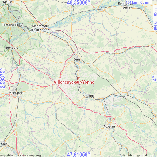
Villeneuve-sur-Yonne GPS coordinates[2]
48° 4' 56.892" North, 3° 17' 48.768" East
| Map corner | latitude | longitude |
|---|---|---|
| Upper-left | 48.55006°, | 2.59375° |
| Center: | 48.08247°, | 3.29688° |
| Lower-right: | 47.61059°, | 4° |
| Map W x H: | 104.5×104.5 km | = 64.9×64.9mi |
| max Lat: | 51.07786° ⇑39.2% North |
| Villeneuve-sur-Yonne: | 48.08247° |
| min Lat: | ⇓60.8% South 41.3874° |
| min Long | Villeneuve-sur- | max Long |
| -5.08615° | 3.29688° | 9.52242° |
| W 62%⇐ | ⇒38% E |
Elevation
Elevation of Villeneuve-sur-Yonne is 80 m = 262 ft, and this is 113.7 m = 373 ft below average elevation for this country.
| Max E: |
2333 m = 7654 ft | 69.2% |
| Avg. | 193.7 m = 635 ft | |
| Villeneuve-sur-Yonne | 80 m = 262 ft | |
Min E: |
-1 m = -3 ft | 30.8% |
See also: France elevation on elevation.city.
Geographical zone
Villeneuve-sur-Yonne is located in North temperate zone (between Tropic of Cancer and the Arctic Circle). Distance of this North polar circle is 2054.9 km =1276.9 mi to North.| Distance of | km | miles | from Villeneuve-sur-Yonne |
|---|---|---|---|
| North Pole | 4660.8 | 2896.1 | to North |
| Arctic Circle | 2054.9 | 1276.9 | to North |
| Tropic Cancer | 2740.4 | 1702.8 | to South |
| Equator | 5346.3 | 3322 | to South |


Nearby cities:
15 places around Villeneuve-sur-Yonne: (largest is in red/bold)
• Armeau
4.4 km =2.7 mi,  155°
155°
• Chaumot
5.8 km =3.6 mi,  267°
267°
• Collemiers
9.4 km =5.8 mi,  330°
330°
• Cézy
10.5 km =6.5 mi, 161°
• Dixmont
8.7 km =5.4 mi,  90°
90°
• Gron
8.9 km =5.5 mi,  343°
343°
• Maillot
10.4 km =6.5 mi,  4°
4°
• Malay-le-Grand
10.9 km =6.8 mi,  17°
17°
• Marsangy
4.2 km =2.6 mi,  316°
316°
• Paron
11.3 km =7 mi, 342°
• Piffonds
11.4 km =7.1 mi,  254°
254°
• Saint-Julien-du-Sault
5.6 km =3.5 mi,  180°
180°
• Véron
5.2 km =3.2 mi,  8°
8°
• Égriselles-le-Bocage
9.5 km =5.9 mi,  296°
296°
• Étigny
6.4 km =4 mi,  356°
356°
Sources, notices
• [Note1] Compared only with cities in France existing in our database
• [Src1] Map data: © OpenStreetMap contributors (CC-BY-SA)
• [Src2] Other city data from geonames.org with taken over terms of usage.
• [Src3] Geographical zone / Annual Mean Temperature by Robert A. Rohde @ Wikipedia
