Malay-le-Grand geodata
Malay-le-Grand (Bourgogne-Franche-Comté) is a populated place; located in France in Europe/Paris (GMT+2) time zone. With population of 1,609 people, there are 5807 cities with bigger population in this country. Compared to other cities in France, 62.4% of cities are located further ↓South; 62.5% of cities are located further ←West and 69.2% of cities have higher elevation than Malay-le-Grand. Note1
Administrative division(s):
- Level 1: Bourgogne-Franche-Comté
- Level 2: Département de l'Yonne
- Level 3: Arrondissement de Sens
- Level 4: Malay-le-Grand


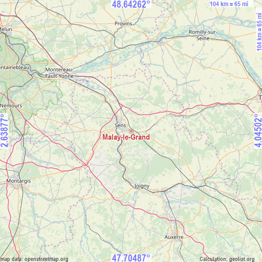
Malay-le-Grand GPS coordinates[2]
48° 10' 33.204" North, 3° 20' 30.804" East
| Map corner | latitude | longitude |
|---|---|---|
| Upper-left | 48.64262°, | 2.63877° |
| Center: | 48.17589°, | 3.34189° |
| Lower-right: | 47.70487°, | 4.04502° |
| Map W x H: | 104.3×104.3 km | = 64.8×64.8mi |
| max Lat: | 51.07786° ⇑37.6% North |
| Malay-le-Grand: | 48.17589° |
| min Lat: | ⇓62.4% South 41.3874° |
| min Long | Malay-le-Grand | max Long |
| -5.08615° | 3.34189° | 9.52242° |
| W 62.5%⇐ | ⇒37.5% E |
Elevation
Elevation of Malay-le-Grand is 80 m = 262 ft, and this is 113.7 m = 373 ft below average elevation for this country.
| Max E: |
2333 m = 7654 ft | 69.2% |
| Avg. | 193.7 m = 635 ft | |
| Malay-le-Grand | 80 m = 262 ft | |
Min E: |
-1 m = -3 ft | 30.8% |
See also: France elevation on elevation.city.
Geographical zone
Malay-le-Grand is located in North temperate zone (between Tropic of Cancer and the Arctic Circle). Distance of this North polar circle is 2044.5 km =1270.4 mi to North.| Distance of | km | miles | from Malay-le-Grand |
|---|---|---|---|
| North Pole | 4650.4 | 2889.6 | to North |
| Arctic Circle | 2044.5 | 1270.4 | to North |
| Tropic Cancer | 2750.7 | 1709.2 | to South |
| Equator | 5356.7 | 3328.5 | to South |


Nearby cities:
15 places around Malay-le-Grand: (largest is in red/bold)
• Collemiers
8.3 km =5.2 mi,  254°
254°
• Courtois-sur-Yonne
8.6 km =5.3 mi,  311°
311°
• Fontaine-la-Gaillarde
5.6 km =3.5 mi,  29°
29°
• Gron
6.1 km =3.8 mi, 252°
• Maillot
2.5 km =1.6 mi,  269°
269°
• Paron
6.8 km =4.2 mi, 272°
• Saint-Clément
5.7 km =3.5 mi,  323°
323°
• Saint-Denis-lès-Sens
8.1 km =5 mi, 316°
• Saint-Martin-du-Tertre
7.5 km =4.7 mi, 307°
• Saligny
4.3 km =2.7 mi,  10°
10°
• Sens
5 km =3.1 mi,  298°
298°
• Soucy
8.3 km =5.2 mi,  350°
350°
• Theil-sur-Vanne
6.3 km =3.9 mi,  99°
99°
• Véron
5.8 km =3.6 mi,  205°
205°
• Étigny
5.5 km =3.4 mi,  222°
222°
Sources, notices
• [Note1] Compared only with cities in France existing in our database
• [Src1] Map data: © OpenStreetMap contributors (CC-BY-SA)
• [Src2] Other city data from geonames.org with taken over terms of usage.
• [Src3] Geographical zone / Annual Mean Temperature by Robert A. Rohde @ Wikipedia
