Armeau geodata
Armeau (Bourgogne-Franche-Comté) is a populated place; located in France in Europe/Paris (GMT+2) time zone. With population of 557 people, there are 14072 cities with bigger population in this country. Compared to other cities in France, 60.2% of cities are located further ↓South; 62.3% of cities are located further ←West and 71.4% of cities have higher elevation than Armeau. Note1
Administrative division(s):
- Level 1: Bourgogne-Franche-Comté
- Level 2: Département de l'Yonne
- Level 3: Arrondissement de Sens
- Level 4: Armeau


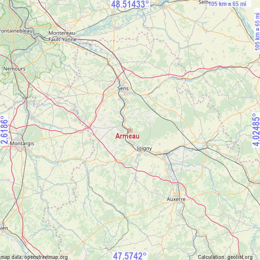
Armeau GPS coordinates[2]
48° 2' 47.076" North, 3° 19' 18.228" East
| Map corner | latitude | longitude |
|---|---|---|
| Upper-left | 48.51433°, | 2.6186° |
| Center: | 48.04641°, | 3.32173° |
| Lower-right: | 47.5742°, | 4.02485° |
| Map W x H: | 104.5×104.5 km | = 64.9×64.9mi |
| max Lat: | 51.07786° ⇑39.8% North |
| Armeau: | 48.04641° |
| min Lat: | ⇓60.2% South 41.3874° |
| min Long | Armeau | max Long |
| -5.08615° | 3.32173° | 9.52242° |
| W 62.3%⇐ | ⇒37.7% E |
Elevation
Elevation of Armeau is 75 m = 246 ft, and this is 118.7 m = 389 ft below average elevation for this country.
| Max E: |
2333 m = 7654 ft | 71.4% |
| Avg. | 193.7 m = 635 ft | |
| Armeau | 75 m = 246 ft | |
Min E: |
-1 m = -3 ft | 28.6% |
See also: France elevation on elevation.city.
Geographical zone
Armeau is located in North temperate zone (between Tropic of Cancer and the Arctic Circle). Distance of this North polar circle is 2058.9 km =1279.3 mi to North.| Distance of | km | miles | from Armeau |
|---|---|---|---|
| North Pole | 4664.8 | 2898.6 | to North |
| Arctic Circle | 2058.9 | 1279.3 | to North |
| Tropic Cancer | 2736.3 | 1700.3 | to South |
| Equator | 5342.3 | 3319.6 | to South |


Nearby cities:
15 places around Armeau: (largest is in red/bold)
• Brion
13 km =8.1 mi,  115°
115°
• Champvallon
12.4 km =7.7 mi,  172°
172°
• Chamvres
10.4 km =6.5 mi,  162°
162°
• Chaumot
8.6 km =5.3 mi,  296°
296°
• Cézy
6.1 km =3.8 mi, 166°
• Dixmont
7.9 km =4.9 mi,  59°
59°
• Joigny
9.2 km =5.7 mi,  140°
140°
• La Celle-Saint-Cyr
8.4 km =5.2 mi,  196°
196°
• Marsangy
8.5 km =5.3 mi,  326°
326°
• Piffonds
12.9 km =8 mi,  274°
274°
• Saint-Julien-du-Sault
2.5 km =1.6 mi,  230°
230°
• Villeneuve-sur-Yonne
4.4 km =2.7 mi,  335°
335°
• Véron
9.2 km =5.7 mi,  353°
353°
• Égriselles-le-Bocage
13.3 km =8.3 mi,  308°
308°
• Étigny
10.6 km =6.6 mi, 347°
Sources, notices
• [Note1] Compared only with cities in France existing in our database
• [Src1] Map data: © OpenStreetMap contributors (CC-BY-SA)
• [Src2] Other city data from geonames.org with taken over terms of usage.
• [Src3] Geographical zone / Annual Mean Temperature by Robert A. Rohde @ Wikipedia
