Villemoyenne geodata
Villemoyenne (Grand Est) is a populated place; located in France in Europe/Paris (GMT+2) time zone. With population of 527 people, there are 14675 cities with bigger population in this country. Compared to other cities in France, 62.5% of cities are located further ↓South; 70% of cities are located further ←West and 51.2% of cities have higher elevation than Villemoyenne. Note1
Administrative division(s):
- Level 1: Grand Est
- Level 2: Département de l'Aube
- Level 3: Arrondissement de Troyes
- Level 4: Villemoyenne


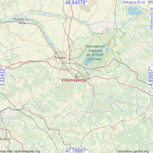
Villemoyenne GPS coordinates[2]
48° 10' 44.616" North, 4° 13' 38.784" East
| Map corner | latitude | longitude |
|---|---|---|
| Upper-left | 48.64576°, | 3.52432° |
| Center: | 48.17906°, | 4.22744° |
| Lower-right: | 47.70807°, | 4.93057° |
| Map W x H: | 104.3×104.3 km | = 64.8×64.8mi |
| max Lat: | 51.07786° ⇑37.5% North |
| Villemoyenne: | 48.17906° |
| min Lat: | ⇓62.5% South 41.3874° |
| min Long | Villemoyenne | max Long |
| -5.08615° | 4.22744° | 9.52242° |
| W 70%⇐ | ⇒30% E |
Elevation
Elevation of Villemoyenne is 128 m = 420 ft, and this is 65.7 m = 216 ft below average elevation for this country.
| Max E: |
2333 m = 7654 ft | 51.2% |
| Avg. | 193.7 m = 635 ft | |
| Villemoyenne | 128 m = 420 ft | |
Min E: |
-1 m = -3 ft | 48.8% |
See also: France elevation on elevation.city.
Geographical zone
Villemoyenne is located in North temperate zone (between Tropic of Cancer and the Arctic Circle). Distance of this North polar circle is 2044.2 km =1270.2 mi to North.| Distance of | km | miles | from Villemoyenne |
|---|---|---|---|
| North Pole | 4650.1 | 2889.4 | to North |
| Arctic Circle | 2044.2 | 1270.2 | to North |
| Tropic Cancer | 2751.1 | 1709.5 | to South |
| Equator | 5357 | 3328.7 | to South |


Nearby cities:
15 places around Villemoyenne: (largest is in red/bold)
• Bar-sur-Seine
13.3 km =8.3 mi,  123°
123°
• Bréviandes
13.1 km =8.1 mi,  311°
311°
• Buchères
10.5 km =6.5 mi, 306°
• Clérey
4.3 km =2.7 mi,  322°
322°
• Isle-Aumont
8.4 km =5.2 mi,  296°
296°
• Lusigny-sur-Barse
8.9 km =5.5 mi,  20°
20°
• Montaulin
8.6 km =5.3 mi,  343°
343°
• Rosières-près-Troyes
14.6 km =9.1 mi, 308°
• Rouilly-Saint-Loup
11 km =6.8 mi,  328°
328°
• Saint-Julien-les-Villas
14 km =8.7 mi, 317°
• Saint-Léger-près-Troyes
12.7 km =7.9 mi, 299°
• Saint-Parres-lès-Vaudes
1.2 km =0.7 mi,  221°
221°
• Vaudes
2.8 km =1.7 mi,  267°
267°
• Verrières
8.4 km =5.2 mi, 316°
• Virey-sous-Bar
7.6 km =4.7 mi,  125°
125°
Sources, notices
• [Note1] Compared only with cities in France existing in our database
• [Src1] Map data: © OpenStreetMap contributors (CC-BY-SA)
• [Src2] Other city data from geonames.org with taken over terms of usage.
• [Src3] Geographical zone / Annual Mean Temperature by Robert A. Rohde @ Wikipedia
