Bar-sur-Seine geodata
Bar-sur-Seine (Grand Est) is a populated place; located in France in Europe/Paris (GMT+2) time zone. With population of 3,838 people, there are 2560 cities with bigger population in this country. Compared to other cities in France, 61.4% of cities are located further ↓South; 71.2% of cities are located further ←West and 55.3% of cities have lower elevation than Bar-sur-Seine. Note1
Administrative division(s):
- Level 1: Grand Est
- Level 2: Département de l'Aube
- Level 3: Arrondissement de Troyes
- Level 4: Bar-sur-Seine


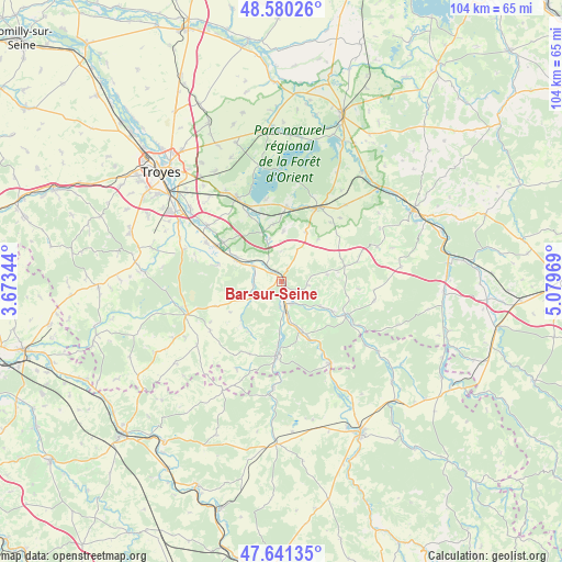
Bar-sur-Seine GPS coordinates[2]
48° 6' 46.62" North, 4° 22' 35.616" East
| Map corner | latitude | longitude |
|---|---|---|
| Upper-left | 48.58026°, | 3.67344° |
| Center: | 48.11295°, | 4.37656° |
| Lower-right: | 47.64135°, | 5.07969° |
| Map W x H: | 104.4×104.4 km | = 64.9×64.9mi |
| max Lat: | 51.07786° ⇑38.6% North |
| Bar-sur-Seine: | 48.11295° |
| min Lat: | ⇓61.4% South 41.3874° |
| min Long | Bar-sur-Seine | max Long |
| -5.08615° | 4.37656° | 9.52242° |
| W 71.2%⇐ | ⇒28.8% E |
Elevation
Elevation of Bar-sur-Seine is 151 m = 495 ft, and this is 42.7 m = 140 ft below average elevation for this country.
| Max E: |
2333 m = 7654 ft | 44.7% |
| Avg. | 193.7 m = 635 ft | |
| Bar-sur-Seine | 151 m = 495 ft | |
Min E: |
-1 m = -3 ft | 55.3% |
See also: France elevation on elevation.city.
Geographical zone
Bar-sur-Seine is located in North temperate zone (between Tropic of Cancer and the Arctic Circle). Distance of this North polar circle is 2051.5 km =1274.7 mi to North.| Distance of | km | miles | from Bar-sur-Seine |
|---|---|---|---|
| North Pole | 4657.4 | 2894 | to North |
| Arctic Circle | 2051.5 | 1274.7 | to North |
| Tropic Cancer | 2743.7 | 1704.9 | to South |
| Equator | 5349.7 | 3324.1 | to South |


Nearby cities:
15 places around Bar-sur-Seine: (largest is in red/bold)
• Chaource
18.7 km =11.6 mi,  251°
251°
• Clérey
17.4 km =10.8 mi,  308°
308°
• Essoyes
13.3 km =8.3 mi,  117°
117°
• Gyé-sur-Seine
10 km =6.2 mi,  157°
157°
• Landreville
8.4 km =5.2 mi, 121°
• Les Riceys
13.2 km =8.2 mi,  182°
182°
• Lusigny-sur-Barse
17.6 km =10.9 mi,  333°
333°
• Montaulin
20.6 km =12.8 mi,  319°
319°
• Mussy-sur-Seine
17.5 km =10.9 mi,  149°
149°
• Saint-Parres-lès-Vaudes
13.5 km =8.4 mi,  298°
298°
• Vaudes
15.7 km =9.8 mi, 297°
• Vendeuvre-sur-Barse
15.5 km =9.6 mi,  26°
26°
• Verrières
21.5 km =13.4 mi, 308°
• Villemoyenne
13.3 km =8.3 mi, 303°
• Virey-sous-Bar
5.7 km =3.5 mi, 301°
Sources, notices
• [Note1] Compared only with cities in France existing in our database
• [Src1] Map data: © OpenStreetMap contributors (CC-BY-SA)
• [Src2] Other city data from geonames.org with taken over terms of usage.
• [Src3] Geographical zone / Annual Mean Temperature by Robert A. Rohde @ Wikipedia
