Villebret geodata
Villebret (Auvergne-Rhône-Alpes) is a populated place; located in France in Europe/Paris (GMT+2) time zone. With population of 1,044 people, there are 8506 cities with bigger population in this country. Compared to other cities in France, 62.7% of cities are located further ↑North; 52.6% of cities are located further ←West and 89.8% of cities have lower elevation than Villebret. Note1
Administrative division(s):
- Level 1: Auvergne-Rhône-Alpes
- Level 2: Département de l'Allier
- Level 3: Arrondissement de Montluçon
- Level 4: Villebret


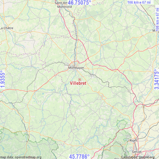
Villebret GPS coordinates[2]
46° 16' 0.588" North, 2° 38' 19.032" East
| Map corner | latitude | longitude |
|---|---|---|
| Upper-left | 46.75075°, | 1.9355° |
| Center: | 46.26683°, | 2.63862° |
| Lower-right: | 45.7786°, | 3.34175° |
| Map W x H: | 108.1×108.1 km | = 67.2×67.2mi |
| max Lat: | 51.07786° ⇑62.7% North |
| Villebret: | 46.26683° |
| min Lat: | ⇓37.3% South 41.3874° |
| min Long | Villebret | max Long |
| -5.08615° | 2.63862° | 9.52242° |
| W 52.6%⇐ | ⇒47.4% E |
Elevation
Elevation of Villebret is 421 m = 1381 ft, and this is 227.3 m = 746 ft above average elevation for this country.
| Max E: |
2333 m = 7654 ft | 10.2% |
| Villebret | 421 m 1381 ft | |
| Avg. | 193.7 m = 635 ft | |
Min E: |
-1 m = -3 ft | 89.8% |
See also: France elevation on elevation.city.
Geographical zone
Villebret is located in North temperate zone (between Tropic of Cancer and the Arctic Circle). Distance of this North polar circle is 2256.8 km =1402.3 mi to North.| Distance of | km | miles | from Villebret |
|---|---|---|---|
| North Pole | 4862.7 | 3021.5 | to North |
| Arctic Circle | 2256.8 | 1402.3 | to North |
| Tropic Cancer | 2538.5 | 1577.4 | to South |
| Equator | 5144.4 | 3196.6 | to South |


Nearby cities:
15 places around Villebret: (largest is in red/bold)
• Budelière
14.1 km =8.8 mi,  248°
248°
• Chamblet
8.8 km =5.5 mi,  33°
33°
• Commentry
8.3 km =5.2 mi,  72°
72°
• Domérat
13.1 km =8.1 mi,  322°
322°
• Doyet
14.4 km =8.9 mi,  57°
57°
• Désertines
9.9 km =6.2 mi,  351°
351°
• Larequille
5.1 km =3.2 mi,  108°
108°
• Lavault-Sainte-Anne
5.6 km =3.5 mi,  328°
328°
• Lignerolles
5.7 km =3.5 mi,  284°
284°
• Malicorne
11.7 km =7.3 mi, 70°
• Marcillat-en-Combraille
11.1 km =6.9 mi,  182°
182°
• Montluçon
8.6 km =5.3 mi,  341°
341°
• Néris-les-Bains
2.7 km =1.7 mi, 34°
• Prémilhat
9.5 km =5.9 mi,  303°
303°
• Quinssaines
11.9 km =7.4 mi, 304°
Sources, notices
• [Note1] Compared only with cities in France existing in our database
• [Src1] Map data: © OpenStreetMap contributors (CC-BY-SA)
• [Src2] Other city data from geonames.org with taken over terms of usage.
• [Src3] Geographical zone / Annual Mean Temperature by Robert A. Rohde @ Wikipedia
