Malicorne geodata
Malicorne (Auvergne-Rhône-Alpes) is a populated place; located in France in Europe/Paris (GMT+2) time zone. With population of 824 people, there are 10351 cities with bigger population in this country. Compared to other cities in France, 62.3% of cities are located further ↑North; 54.7% of cities are located further ←West and 88.5% of cities have lower elevation than Malicorne. Note1
Administrative division(s):
- Level 1: Auvergne-Rhône-Alpes
- Level 2: Département de l'Allier
- Level 3: Arrondissement de Montluçon
- Level 4: Malicorne


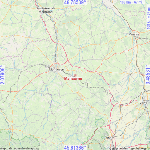
Malicorne GPS coordinates[2]
46° 18' 6.408" North, 2° 46' 55.848" East
| Map corner | latitude | longitude |
|---|---|---|
| Upper-left | 46.78539°, | 2.07906° |
| Center: | 46.30178°, | 2.78218° |
| Lower-right: | 45.81386°, | 3.48531° |
| Map W x H: | 108×108 km | = 67.1×67.1mi |
| max Lat: | 51.07786° ⇑62.3% North |
| Malicorne: | 46.30178° |
| min Lat: | ⇓37.7% South 41.3874° |
| min Long | Malicorne | max Long |
| -5.08615° | 2.78218° | 9.52242° |
| W 54.7%⇐ | ⇒45.3% E |
Elevation
Elevation of Malicorne is 397 m = 1302 ft, and this is 203.3 m = 667 ft above average elevation for this country.
| Max E: |
2333 m = 7654 ft | 11.5% |
| Malicorne | 397 m 1302 ft | |
| Avg. | 193.7 m = 635 ft | |
Min E: |
-1 m = -3 ft | 88.5% |
See also: France elevation on elevation.city.
Geographical zone
Malicorne is located in North temperate zone (between Tropic of Cancer and the Arctic Circle). Distance of this North polar circle is 2252.9 km =1399.9 mi to North.| Distance of | km | miles | from Malicorne |
|---|---|---|---|
| North Pole | 4858.8 | 3019.1 | to North |
| Arctic Circle | 2252.9 | 1399.9 | to North |
| Tropic Cancer | 2542.4 | 1579.8 | to South |
| Equator | 5148.3 | 3199 | to South |


Nearby cities:
15 places around Malicorne: (largest is in red/bold)
• Bézenet
5.7 km =3.5 mi,  57°
57°
• Chamblet
7 km =4.3 mi,  299°
299°
• Commentry
3.4 km =2.1 mi,  245°
245°
• Doyet
3.9 km =2.4 mi,  17°
17°
• Désertines
13.8 km =8.6 mi, 295°
• Lapeyrouse
11.1 km =6.9 mi,  141°
141°
• Larequille
8.3 km =5.2 mi,  228°
228°
• Lavault-Sainte-Anne
14 km =8.7 mi,  273°
273°
• Montaigut
13.8 km =8.6 mi,  171°
171°
• Montmarault
13.4 km =8.3 mi,  82°
82°
• Montvicq
3.6 km =2.2 mi, 56°
• Néris-les-Bains
9.6 km =6 mi,  260°
260°
• Verneix
13.6 km =8.5 mi,  320°
320°
• Villebret
11.7 km =7.3 mi, 250°
• Villefranche-d’Allier
12 km =7.5 mi,  28°
28°
Sources, notices
• [Note1] Compared only with cities in France existing in our database
• [Src1] Map data: © OpenStreetMap contributors (CC-BY-SA)
• [Src2] Other city data from geonames.org with taken over terms of usage.
• [Src3] Geographical zone / Annual Mean Temperature by Robert A. Rohde @ Wikipedia
